
 4 months ago
102
4 months ago
102
PROTECT YOUR DNA WITH QUANTUM TECHNOLOGY
Orgo-Life the new way to the future Advertising by AdpathwayDisclaimer: This site is not affiliated with the National Hurricane Center, Hurricane Hunters, Storm Prediction Center, or National Weather Service. ALL forecasts herein are the result of my analysis, (to which you will see me at times, insert excerpts from various agencies due to the nature of the importance of the information) and I am solely responsible for the content. As ALWAYS, follow the National Hurricane Center, National Weather Service, and your local Emergency Management officials for emergency decisions. In addition, this is strictly a FORECAST OFFICE. I CANNOT make decisions regarding travel plans, etc. My purpose, is to provide you the information, based solely on information I analyze, and the accuracy of the information at hand of the time of analysis, so you may make informed decisions.
(T. F. “Storm” Walsh)
For those who have donated to my site, your help has been greatly appreciated. If you are not aware, donations to my site help pay for subscriptions to sites I use as well as software updates, which provide all the models and information used in my forecasts. To donate, please click the DONATE button to the right side of the page, or on the graphic of the dog. Any help you provide is immensely appreciated!
DONATIONS ACCEPTED AND APPRECIATED


I will reiterate, my forecasts are based on the available information at the time of analysis, and are only as accurate as the information analyzed and the solutions provided.
Good day everyone!
For those who may be wondering why I did not address the severe weather for yesterday…the preliminary data from the prior evening indicated only a MARGINAL risk, with both tornado and hail probabilities slated at less than 2%. The SPC did not upgrade until yesterday morning. The original time frame from the prior evening indicated the strongest activity to occur from 12Z – 16Z EDT (8 a.m. – 12 noon). By the time I would have issued my forecast, the “event”, based on that time frame, would have been weakening, thus I would not have been able to provide enough early warning to prepare residents within the affected areas prior to the onset.
The Storm Prediction Center (SPC) has issued an ENHANCED risk for severe thunderstorms in the current DAY 3 Outlook: FROM NORTHEAST ARKANSAS INTO INDIANA…
…SPC SUMMARY…
Potential for a widespread damaging wind event along with a few tornadoes exists from Sunday afternoon through Sunday night from northeast Texas to southwest Lower Michigan. The greatest threat appears to be from northeast Arkansas into Indiana during the evening and overnight hours.
SPC DAY 3 SEVERE THUNDERSTORM OUTLOOK (LINKED FOR OUTLOOK TEXT)

The following is the day 3 severe probabilities from the CSU – MLP severe weather forecast map vs the SPC forecast, and the NSSL ML DAY 3 severe probability.
CSU – MLP DAY 3 FORECAST (CLICK FOR LARGER IMAGE)
NSSL DAY 3 SEVERE FORECAST PROBABILITY 

DAY 3 PROBABILITY CONVERSION TABLE
SPC DISCUSSION EXCERPT:
Initial activity will occur along the cold front during the late afternoon where instability will be strongest, perhaps as high as 1000 J/kg from AR into TX. It should be noted that substantial variability exists among models regarding instability and capping, though strong ascent near the front should mitigate these factors. Hail and damaging gusts may occur with the late afternoon activity.
Of greatest concern is potential for a severe squall line capable of widespread wind damage, along with a few tornadoes, developing during the evening across northeast AR, southeast MO, much of southern IL, central and southern IN, western KY and TN. The shear environment will be rapidly increasing during this time,The shear environment will be rapidly increasing during this time, and w and while forecast soundings show low levels of instability, it will be more than sufficient to sustain a strongly forced QLCS, producing corridors of significant wind damage and a few embedded tornadoes. Southerly winds at 850 mb along the front may exceed 70 kt, with a very strong frontal surge out of the west.
Since preliminary severe indices are just out of the range of the NAM 3km model, I will not be posting forecast indices today, however as this becomes DAY 2 (tomorrow) in the forecast period, I will be performing a full analysis with indices being posted, since the forecast center is closed on Sunday. Please visit the SPC homepage on Sunday for any updates to the forecast:
https://www.spc.noaa.gov/
Elsewhere, the SPC has introduced a probable ENHANCED severe risk for DAY 4 (Monday): OVER PARTS OF THE CAROLINAS AND MID ATLANTIC…
SPC DAY 4 SEVERE THUNDERSTORM OUTLOOK (LINKED FOR OUTLOOK TEXT)
…DISCUSSION EXCERPT…
Significant severe winds and the potential for a few tornadoes will develop on Monday over parts of the Carolinas and Mid Atlantic.
Given the antecedent upper ridging on the previous day, low-level southerly winds will help to moisten the air mass well ahead of an approaching cold front. By 12Z Monday, 60s F dewpoints will already extend from northern GA across the Piedmont and into southeast VA, and this plume of moisture will rapidly spread north with near 60 F dewpoints into southeast PA by 00Z.
There appears to be two regimes for severe potential on Monday. First, up to 1000 J/kg MUCAPE may develop well ahead of the approaching cold front, and there is some indication that scattered convection may occur across the warm sector from mid to late afternoon. If this occurs, supercells would be most likely, with potential for a few tornadoes from the Carolinas into eastern VA.
Models also indicate an elongated pressure fall/rise couplet, which when combined with 50-70 kt 850 mb winds and extreme low-level shear, could easily result in a QLCS along the cold front with corridors of significant damaging winds and embedded tornado risk.
CSU – MLP AND NSSL ML DAY 4 SEVERE WEATHER PROBABILITY FORECAST

I should have a complete forecast on this on Monday.
NADOCAST forecast maps will not be available as they are only issued for Day 1 severe weather events.
I will continue to monitor the situation for any changes to the SPC outlooks and will try to update information as warranted.
Elsewhere, another round of Arctic air is forecast to plunge southward, and affect areas all the way down to Florida by St. Patrick’s day:
ECMWF MINIMUM SURFACE TEMPERATURE FORECAST MAR. 17 – 18
 The following links will connect you to the Excessive Rainfall probabilities and River Flood Outlook:
EXCESSIVE RAINFALL
https://www.wpc.ncep.noaa.gov/qpf/excessive_rainfall_outlook_ero.php
SIGNIFICANT RIVER FLOOD OUTLOOK
https://www.wpc.ncep.noaa.gov/nationalfloodoutlook/index.html
The following NWS Watch / Warning map will provide local NWS information for your area. Click the image, then once it refreshes, click on your area of interest to view forecasts, any special weather statements, hazards or advisories for your area.
NWS WATCH / WARNING DISPLAY (LINKED…CLICK MAP, THEN YOUR AREA)
NWS DOPPLER RADAR LOOP (LINKED, CLICK RADAR MAP)
RAP RADAR (CLICK IMAGE THEN GO TO LOOP DURATION AND PICK LENGTH OF LOOP, THEN CLICK RADAR SITE)
WUNDERGROUND RADAR SUMMARY MAP (CLICK FOR UPDATES)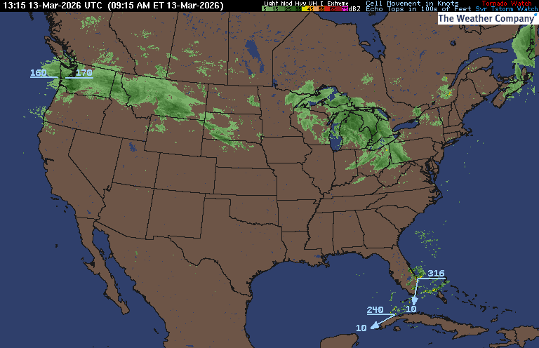
PRECIPITATION TYPE (CLICK TO ACCESS ANIMATION FEATURE)
CARIBBEAN RADAR (CLICK IMAGE TO ACCESS ANIMATION)
You may direct any questions by contacting me personally, ANYTIME, at: [email protected]
Have a blessed day!
T. F. “STORM” WALSH III
GMCS, USCG (ret)
METEOROLOGIST / HURRICANE SPECIALIST /SEVERE WEATHER SPECIALIST


 English (US) ·
  French (CA) ·