
 6 months ago
157
6 months ago
157
PROTECT YOUR DNA WITH QUANTUM TECHNOLOGY
Orgo-Life the new way to the future Advertising by AdpathwayDisclaimer: This site is not affiliated with the National Hurricane Center, Hurricane Hunters, Storm Prediction Center, or National Weather Service. ALL forecasts herein are the result of my analysis, (to which you will see me at times, insert excerpts from various agencies due to the nature of the importance of the information) and I am solely responsible for the content. As ALWAYS, follow the National Hurricane Center, National Weather Service, and your local Emergency Management officials for emergency decisions. In addition, this is strictly a FORECAST OFFICE. I CANNOT make decisions regarding travel plans, etc. My purpose, is to provide you the information, based solely on information I analyze, and the accuracy of the information at hand of the time of analysis, so you may make informed decisions.
(T. F. “Storm” Walsh)
For those who have donated to my site, your help has been greatly appreciated. If you are not aware, donations to my site help pay for subscriptions to sites I use as well as software updates, which provide all the models and information used in my forecasts. To donate, please click the DONATE button to the right side of the page, or on the graphic of the dog. Any help you provide is immensely appreciated!
DONATIONS ACCEPTED AND APPRECIATED


I will reiterate, my forecasts are based on the available information at the time of analysis, and are only as accurate as the information analyzed and the solutions provided.
Good day everyone!
Just to reiterate, though some of my forecasts may not directly apply to you, I have no idea where your families or friends reside, and is the reason you may receive the forecasts.
The Storm Prediction Center (SPC) has issued a MARGINAL risk for severe thunderstorms in the current DAY 3 Outlook: in MO/AR/TN/KY/OH…
…SPC SUMMARY…
Isolated severe thunderstorms are possible on Sunday into Sunday night from Arkansas and Missouri into parts of the Ohio and Tennessee Valleys
SPC DAY 3 SEVERE THUNDERSTORM OUTLOOK (LINKED FOR OUTLOOK TEXT)

The following is the day 3 outlook from the CSU – MLP severe weather forecast map vs the SPC forecast, and the NSSL ML day 3 severe probability with both indicating a possible upgrade to a slight risk outline:
CSU – MLP DAY 3 FORECAST (CLICK FOR LARGER IMAGE)
NSSL DAY 3 SEVERE FORECAST PROBABILITY (LINKED)

DAY 3 PROBABILITY CONVERSION TABLE
SPC DISCUSSION EXCERPT:
Isolated to scattered elevated convection within the strengthening low-level warm conveyor should persist, yielding a northern limiter to potential severe thunderstorms later in the day through Sunday night. Outside of the likely too cool/stable 00Z NAM, bulk of preferred guidance suggest weak surface-based destabilization may occur as a broad plume of upper 50s to low 60s surface dewpoints becomes established ahead of the front and deepening cyclone. Richer boundary-layer moisture with at least mid 60s surface dewpoints should largely hold over the Lower MS Valley and Deep South.
Late afternoon surface-based storms may develop over the Mid-MS Valley/Ozarks vicinity. Amid broadening large-scale ascent, upscale growth into a thin but long QLCS seems plausible along the front given the orientation of the deep-layer winds. Despite only minimal to meager surface-based instability on Sunday night, intensifying wind fields throughout the troposphere could support a convective line with/without lightning. This may yield a threat of sporadic strong to severe gusts producing at least isolated damaging winds.
Based on analysis of some severe forecast indices and parameters this morning, the atmosphere is currently forecast to be fairly stable, but with somewhat moderate mid level lapse rates at around 6.5 – 7.0 C/km. Forecast lifted indices indicate zero to extremely weak instability, ranging from 6 to -2. SBCAPE is currently forecast between 0 – 50 J/kg-1, and MLCAPE <50 J/kg-1 The main threat for Sunday appears to be the possibility of damaging wind and gusts, based on bulk wind shear of around 40 – 50 kts, and SRH (Storm Relative Helicity, a measure of turning in the atmosphere) values of 200 – 400. Based on lack of lift and instability, I currently do not expect any tornado or hail activity. I intend on providing an updated forecast with severe indices and parameters tomorrow, however indices could differ by the Day 1 outlook, so please refer to the SPC homepage regarding the Day 1 outlook on Sunday. NADOCAST forecast maps will not be available as they are only issued for the Day 1 severe weather events. I will not be available on Sunday for the Day 1 outlook.
The following links will connect you to the Excessive Rainfall probabilities and River Flood Outlook:
EXCESSIVE RAINFALL
https://www.wpc.ncep.noaa.gov/qpf/excessive_rainfall_outlook_ero.php
SIGNIFICANT RIVER FLOOD OUTLOOK
https://www.wpc.ncep.noaa.gov/nationalfloodoutlook/index.html
The following NWS Watch / Warning map will provide local NWS information for your area. Click the image, then once it refreshes, click on your area of interest to view forecasts, any special weather statements, hazards or advisories for your area.
NWS WATCH / WARNING DISPLAY (LINKED…CLICK MAP, THEN YOUR AREA)
NWS DOPPLER RADAR LOOP (LINKED, CLICK RADAR MAP)
RAP RADAR (CLICK IMAGE THEN GO TO LOOP DURATION AND PICK LENGTH OF LOOP, THEN CLICK RADAR SITE)
WUNDERGROUND RADAR SUMMARY MAP (CLICK FOR UPDATES)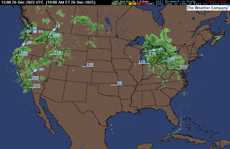
PRECIPITATION TYPE (CLICK TO ACCESS ANIMATION FEATURE)
CARIBBEAN RADAR (CLICK IMAGE TO ACCESS ANIMATION)
You may direct any questions by contacting me personally, ANYTIME, at: [email protected]
Have a blessed day!
T. F. “STORM” WALSH III
GMCS, USCG (ret)
METEOROLOGIST / HURRICANE SPECIALIST /SEVERE WEATHER SPECIALIST


 English (US) ·
  French (CA) ·