

 5 hours ago
6
PROTECT YOUR DNA WITH QUANTUM TECHNOLOGY
Orgo-Life the new way to the future Advertising by AdpathwaySix years of Sentinel-1 radar show part of Masaya's caldera sank and then rose while the area around its active crater kept sinking. Researchers say the findings show no immediate danger.
About 2 million people live within 13 miles (21 kilometers) of Nicaragua's Masaya volcano, and new satellite measurements suggest the magma system beneath them is more complicated than scientists thought. A Penn State team reported in Geophysical Research Letters that Masaya appears to have at least two active magma reservoirs, one possibly filling and one draining, at the same time.
The researchers stressed that their observations revealed no immediate danger to nearby communities. Instead, the work offers a clearer baseline that could help Nicaraguan monitors spot unusual changes earlier.
Masaya sits about 12 miles (20 kilometers) southeast of Managua, the capital, and its national park is a popular tourist destination. That combination of a dense population, steady visitor traffic, and a volcano that rarely sits quiet is why better forecasting matters here.
Two Reservoirs Moving in Opposite Directions
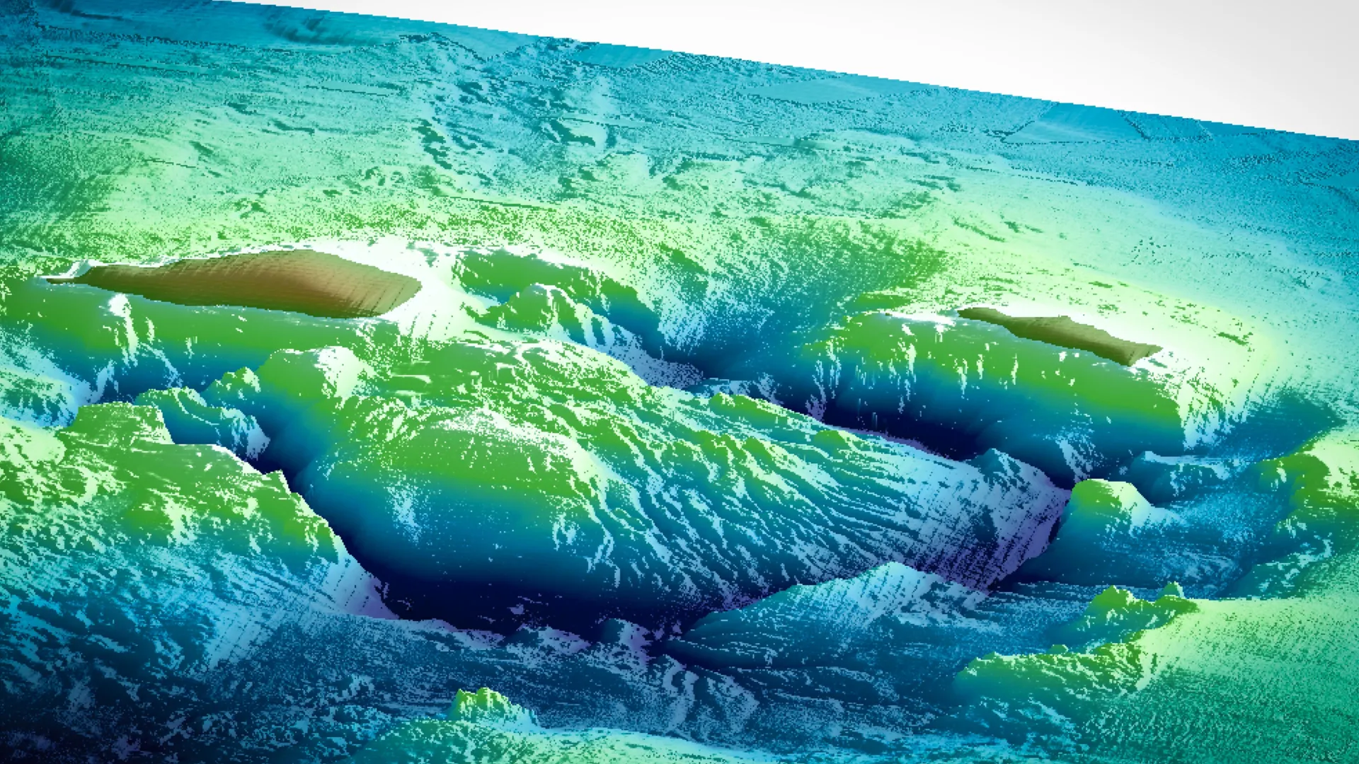
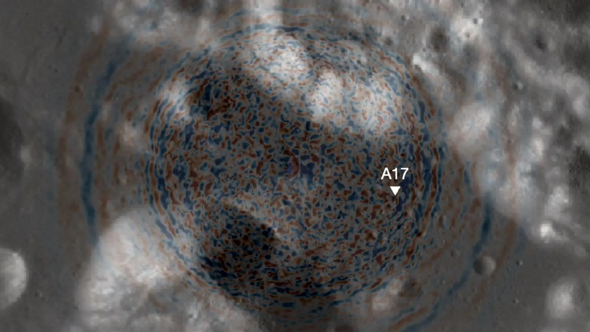
The team analyzed ground motion from 2018 to 2024. During the first part of that period, the ground inside Masaya's caldera slowly sank, then the same broad area began to rise. The researchers said that pattern could reflect magma draining away and later new magma moving into a deeper main reservoir.
The surprise was the area around the active Santiago crater, home to the volcano's lava lake. It kept sinking for the entire six years, even after the wider caldera began to swell.
"This indicates that the plumbing system is more complex and could be due to decreasing magma in a second, shallower reservoir," lead author Lizzie Johnson said, according to Penn State. Johnson, who completed the work as an undergraduate honors thesis, has since begun a doctoral program at the University of Hawaii at Manoa studying Kīlauea.
Two sources complicate forecasting because a single signal can be misleading. If monitors watched only the crater, they would see steady deflation and might assume the system was quieting — while the broader caldera was actually inflating.
Radar Satellites That See Through Tropical Clouds
The measurements came from the European Sentinel-1 satellite, which passes over Masaya about every 12 days. The team used interferometric synthetic aperture radar, or InSAR, which compares radar signals from repeated passes to detect tiny changes in the distance between the satellite and the ground.
Radar matters in the tropics because it works through clouds. "Cloud penetration is important for volcanoes because many of them, like Masaya, are in tropical areas where there is often cloud cover," said co-author Young Cheol Kim, who completed his doctorate at Penn State this summer.
This is not the group's first look at Masaya. In 2018, a team led by Penn State professor Christelle Wauthier, the senior author on the new paper, used InSAR to detect a major magma supply into a reservoir extending almost 2 miles from the crater. "If magma supply is increasing significantly, it's a sign the volcano could become more active," Wauthier said at the time.
Nearly 2 Million Neighbors and a Busy National Park
Masaya's main hazard for most residents is not lava — it is gas. The volcano last produced a major lava flow in 1772, but it degasses persistently. "Its persistent degassing often produces dangerously high concentrations of sulfur dioxide volcanic gas," Johnson said.
The crater rim brings different risks for visitors. On April 23, 2001, a sudden explosion threw rock fragments up to about 2 feet (60 centimeters) across as far as about 1,640 feet (500 meters) from the crater and damaged vehicles at the visitor platform, according to the Smithsonian Global Volcanism Program. In March 2024, landslides buried the lava lake, the park closed, and the public was warned to stay about half a mile (800 meters) from Santiago crater.
Activity has continued into this fall. The Washington Volcanic Ash Advisory Center reported diffuse ash plumes rising to 7,000 to 8,000 feet above sea level on Sept. 28 and to 4,000 to 5,000 feet on Oct. 9, the Smithsonian's weekly reports show. Those small emissions are typical for Masaya and were not described as a change in eruption risk.
The people most affected by gas and ash are communities downwind to the west and southwest, farmers whose crops can be damaged by acid gas, people with asthma or heart and lung conditions, and park staff and tourists near the crater rim.
Reading the Findings Without Reading Into Them
Evidence check: this is a peer-reviewed observational study based on six years of satellite geodesy. It shows ground movement and offers the most likely interpretation, but it does not directly image magma, measure magma volume, or forecast an eruption. The authors said longer-term geodetic data and computer modeling are needed to confirm how the two reservoirs connect.
The work was funded by the U.S. National Science Foundation, and the authors said the conclusions are their own. Nature World News did not find an independent volcanologist's published comment on the paper, and Nicaragua's monitoring agency, INETER, had not issued a public statement on the study as of publication.
For travelers, including the many U.S. visitors who tour the park, the practical steps are routine. Check INETER and the U.S. Embassy in Managua for park status before visiting, follow ranger instructions, limit time at the crater rim, and leave if gas makes breathing uncomfortable. Visitors with asthma or heart conditions should consider skipping the rim altogether. Local residents should follow guidance from INETER and Nicaragua's disaster-management agency rather than social media claims.
What happens next is continued satellite and ground monitoring, with the researchers calling for long-term studies at Masaya and other lava-lake volcanoes. The bottom line is that Masaya's underground plumbing looks more complex than expected, nothing in this study signals an imminent eruption, and better baselines should make real warning signs easier to recognize.
What Readers Want to Know
What did scientists find under Masaya volcano?
Satellite radar suggests at least two active magma reservoirs. A deeper main reservoir may be refilling while a shallower one near Santiago crater appears to be losing magma.
Does this mean Masaya is about to erupt?
No. The researchers said their observations revealed no immediate danger. The study does not forecast an eruption.
How many people live near Masaya?
About 2 million people live within 13 miles of the volcano, according to Penn State.
How do satellites detect magma movement?
InSAR compares radar images from repeated satellite passes to measure tiny rises or drops in the ground, even through clouds.
What is the main hazard for nearby residents?
Persistent sulfur dioxide gas, which can harm people with breathing conditions and damage crops downwind.
Is Masaya Volcano National Park safe to visit?
Park access can change quickly. Check with INETER and the U.S. Embassy in Managua before visiting and follow ranger instructions.
© 2026 NatureWorldNews.com All rights reserved. Do not reproduce without permission.








 English (US) ·
 French (CA) ·