
 8 months ago
133
8 months ago
133
PROTECT YOUR DNA WITH QUANTUM TECHNOLOGY
Orgo-Life the new way to the future Advertising by AdpathwayDisclaimer: This site is not affiliated with the National Hurricane Center, Hurricane Hunters, Storm Prediction Center, or National Weather Service. ALL forecasts herein are the result of my analysis, (to which you will see me at times, insert excerpts from various agencies due to the nature of the importance of the information) and I am solely responsible for the content. As ALWAYS, follow the National Hurricane Center, National Weather Service, and your local Emergency Management officials for emergency decisions. In addition, this is strictly a FORECAST OFFICE. I CANNOT make decisions regarding travel plans, etc. My purpose, is to provide you the information, based solely on information I analyze, and the accuracy of the information at hand of the time of analysis, so you may make informed decisions.
(T. F. “Storm” Walsh)
For those who have donated to my site, your help has been greatly appreciated. If you are not aware, donations to my site help pay for subscriptions to sites I use as well as software updates, which provide all the models and information used in my forecasts. To donate, please click the DONATE button to the right side of the page, or on the graphic of the dog. Any help you provide is immensely appreciated!
DONATIONS ACCEPTED AND APPRECIATED


I will reiterate, my forecasts are based on the available information at the time of analysis, and are only as accurate as the information analyzed and the solutions provided.
Good day everyone!
Just a little side note…it was 50 years ago today, that I began Basic Training at USCG Training Center Cape May, NJ.
Over the past few days, the ML (Machine Learning) forecast models have indicated a probability of a SLIGHT severe risk for today, and MARGINAL risks for the remainder of the week mainly over the central portion of the U.S. However, it currently appears the modeling was bullish in the probs.
The Storm Prediction Center (SPC) has issued no threat risk for severe thunderstorms in the current DAY 1 Outlook for the Ohio Valley vicinity: NO SEVERE THUNDERSTORM AREAS FORECAST
…SPC SUMMARY…
Scattered thunderstorms should occur this evening and overnight across parts of the northern/central Plains into the Ozarks and mid Mississippi Valley. Isolated thunderstorms are also possible across the Southwest and central California. A few strong thunderstorms may occur across parts of Missouri and southern Illinois late tonight, but organized severe thunderstorm potential appears low.
SPC DAY 1 SEVERE THUNDERSTORM OUTLOOK (LINKED FOR OUTLOOK TEXT)
TORNADO PROBABILITY
Probability of a tornado within 25 miles of a point.
HAIL PROBABILITY
Probability of one inch diameter hail or larger within 25 miles of a point.
DAMAGING THUNDERSTORM WIND PROBABILITY
Probability of damaging thunderstorm winds or wind gusts of 50 knots or higher within 25 miles of a point.
The following is the current CSU – MLP severe weather forecast map:
CSU – MLP DAY 1 FORECAST (CLICK FOR LARGER IMAGE)

DAY 1 PROBABILITY CONVERSION TABLE
SPC DISCUSSION EXCERPT:
…Ozarks into the Mid Mississippi Valley…
Low-level moisture will continue to stream northward across the southern Plains and lower/mid MS Valley ahead of a weak surface low and cold front related to the lead upper trough/low. Latest NAM/RAP forecast soundings across the surface warm sector this afternoon/evening continue to show a substantial cap in place, which combined with negligible large-scale ascent should act to inhibit surface-based convective development. Low-level warm/moist advection is expected to increase this evening/overnight as a southwesterly low-level jet strengthens over the Ozarks/mid MS Valley. Most guidance shows weak MUCAPE (around 500-1000 J/kg) with modest mid-level lapse rates present. This should tend to limit the updraft strength of scattered elevated convection that is forecast develop tonight across MO into parts of southern IL, even in the presence of moderate to strong deep-layer shear. While small/sub-severe hail may occur with the stronger cores, the threat for severe hail appears too limited to include low probabilities with this update.
The following maps are tornado and significant tornado probabilities from NADOCAST, with the tornado probability indicating less than 1%:
00Z NADOCAST TORNADO PROBABILITY (CLICK FOR LARGER IMAGE)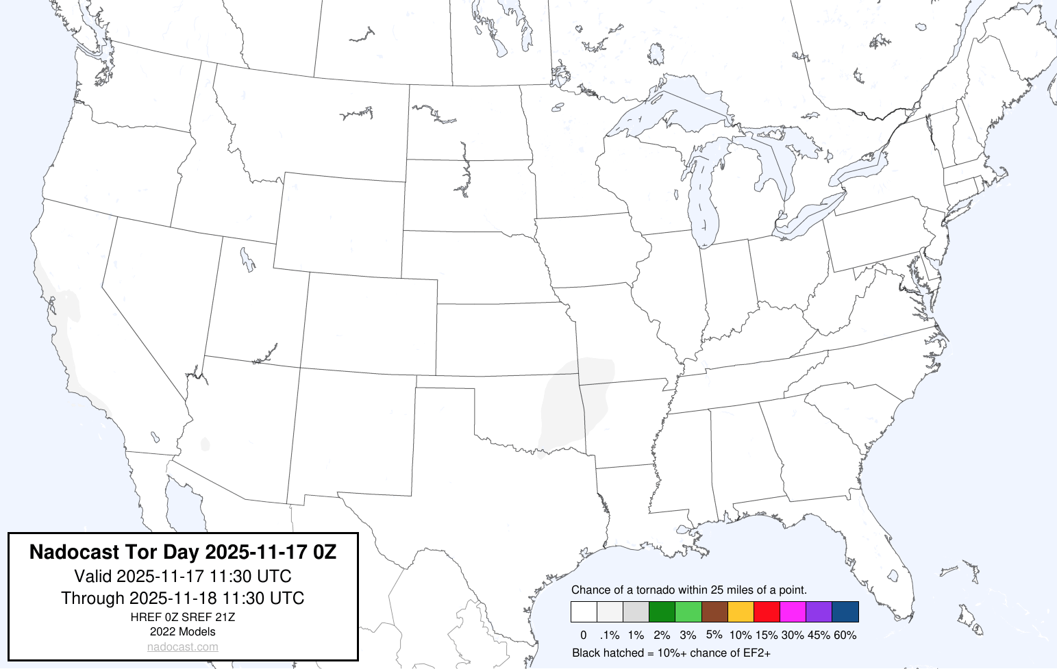
00Z NADOCAST SIGTOR PROBABILITY (CLICK FOR LARGER IMAGE)
Based on my analysis of the severe weather indices, some isolated small hail could occur in stronger storms, based on bulk shear of 50 – 60 kts, and limited updraft helicity
Elsewhere, although the ML models are still forecasting MARGINAL risks through the week, the SPC has not designated any severe thunderstorm activity. On Wed. Nov. 19, the SPC indicates probabilities could be introduced in later updates. From the SPC: At the surface, southerly low-level flow will transport Gulf moisture northward across TX/OK and the south-central states. Forecast soundings suggest capping in the 850-700 mb layer will persist for much of the diurnal period. Given nebulous forcing, outside of persistent, modest warm advection, it is unclear if/how much convection may develop across the warm sector during the day. The 00z RRFS suggests elevated convection may develop near the moisture gradient/surface trough across west-central TX and toward the Red River in southwest OK by late afternoon. While vertical shear would support at least loosely organized convection, low to midlevel flow will be somewhat weak, and elevated instability modest (generally less than 1000 J/kg). Later in the period (after 06z), large-scale ascent will increase and a modest southerly low-level jet should intensify as the upper trough approaches NM. Additional convection may develop late Wednesday night into early Thursday morning amid a stronger mass response.
Some risk for marginal hail could accompany stronger convection. However, confidence is low regarding coverage, intensity and timing of any more organized/stronger storm development, especially given the trend toward a more slowly/later ejecting trough. Will hold off introducing severe probabilities at this time, but probs could become necessary with later updates.
Please use the following maps, which should update automatically, for Mesoscale Discussions and Convective Watches. You may have to refresh your browser, or click on the graphics. I have provided the SPC homepage link below, so you may get the updated information regarding any changes to the outlook:
https://www.spc.noaa.gov/classic.html
SPC MESOSCALE DISCUSSIONS (CLICK IMAGE FOR UPDATES)
SPC CONVECTIVE WATCHES (CLICK IMAGE FOR UPDATES)
Elsewhere, we are still in the easterly phase of the QBO, and stratospheric warming continues to progress. By days 5 – 7 in the current forecast period, the higher temperature and height anomalies should be pretty much centered of the Arctic region. As this continues, colder air will continue to slowly progress from the Pacific NW through Thanksgiving week. OOA (On Or About) Dec. 01, very cold temperatures will once again affect the majority of the CONUS, with some Arctic air spilling into the Pacific NW and north central portions of the U.S.
ECMWF 30 MB TEMPERATURE AND HEIGHT ANOMALIES FORECAST DAY 7

ECMWF MINIMUM TEMPERATURE FORECAST DEC. 01, 2025

ECMWF APPARENT TEMPERATURE FORECAST DEC. 01, 2025

ECMWF 120 TOTAL SNOWFALL ACCUMULATION AND PRECIPITATION BY TYPE


WPC 7 DAY TOTAL RAINFALL FORECAST
The following links will connect you to the Excessive Rainfall probabilities and River Flood Outlook:
EXCESSIVE RAINFALL
https://www.wpc.ncep.noaa.gov/qpf/excessive_rainfall_outlook_ero.php
SIGNIFICANT RIVER FLOOD OUTLOOK
https://www.wpc.ncep.noaa.gov/nationalfloodoutlook/index.html
The following NWS Watch / Warning map will provide local NWS information for your area. Click the image, then once it refreshes, click on your area of interest to view any special weather statements, hazards or advisories for your area.
NWS WATCH / WARNING DISPLAY (LINKED…CLICK MAP, THEN YOUR AREA)
NWS DOPPLER RADAR LOOP (LINKED, CLICK RADAR MAP)
RAP RADAR (CLICK IMAGE THEN GO TO LOOP DURATION AND PICK LENGTH OF LOOP, THEN CLICK RADAR SITE)
CARIBBEAN RADAR (CLICK IMAGE TO ACCESS ANIMATION)
You may direct any questions by contacting me personally, ANYTIME, at: [email protected]
Have a blessed day!
T. F. “STORM” WALSH III
GMCS, USCG (ret)
METEOROLOGIST / HURRICANE SPECIALIST /SEVERE WEATHER SPECIALIST


 English (US) ·
  French (CA) ·