
 5 months ago
150
5 months ago
150
PROTECT YOUR DNA WITH QUANTUM TECHNOLOGY
Orgo-Life the new way to the future Advertising by AdpathwayDisclaimer: This site is not affiliated with the National Hurricane Center, Hurricane Hunters, Storm Prediction Center, or National Weather Service. ALL forecasts herein are the result of my analysis, (to which you will see me at times, insert excerpts from various agencies due to the nature of the importance of the information) and I am solely responsible for the content. As ALWAYS, follow the National Hurricane Center, National Weather Service, and your local Emergency Management officials for emergency decisions. In addition, this is strictly a FORECAST OFFICE. I CANNOT make decisions regarding travel plans, etc. My purpose, is to provide you the information, based solely on information I analyze, and the accuracy of the information at hand of the time of analysis, so you may make informed decisions.
(T. F. “Storm” Walsh)
Thanks to all of you that still follow my forecasts. I truly appreciate each and every one of you!
For those who have donated to my site, your help has been greatly appreciated. If you are not aware, donations to my site help pay for subscriptions to sites I use as well as software updates, which provide all the models and information used in my forecasts. To donate, please click the DONATE button to the right side of the page, or on the graphic of the dog. Any help you provide is immensely appreciated!
DONATIONS NEEDED AND APPRECIATED


I will reiterate, my forecasts are based on the available information at the time of analysis, and are only as accurate as the information analyzed and the solutions provided.
Good day everyone!
The Storm Prediction Center does not indicate any severe weather probabilities, for the week. Should a risk be introduced, it will be included in the future synopses.
I will be using the ECMWF model for the main forecast graphics for winter weather forecasts. Over my years of forecasting, I prefer this model, as numerous articles depict the ECMWF to be the more accurate model as compared to the GFS. Here is an excerpt from an article I found:
The ECMWF model’s resolution is 9km or about 5.5 miles. The GFS has a resolution of 25km or roughly 15.5 miles. This resolution is the distance between two points on a grid that the weather model uses. The smaller the number, the better the resolution/quality of a forecast. The European Center for Medium-Range Weather Forecasts (ECMWF) model is another global numerical weather prediction model that is highly regarded for its accuracy. It employs advanced data assimilation techniques and sophisticated numerical algorithms to simulate atmospheric processes. The ECMWF model provides high-resolution forecasts for various meteorological variables, enabling forecasters to make more precise predictions. According to current weather forecasting standards, the ECMWF model is generally considered the most accurate for predicting snowfall totals, often performing slightly better than American weather models like the GFS.
For forecast temperatures less than 72 hours out in the forecast period, I prefer using the NAM (North American Mesoscale) model. This is what we refer to as a regional model, vice a global model, with its forecast grids within the North American continent. The NAM 3km only goes out to 60 hours, and the NAM 12km goes out to 84 hours.
Should a forecast indicate very cold temperatures, or cold snowy weather:

The following link is from the Animal Welfare Act, and provides guidelines for temperatures regarding your animal:
ANIMAL WELFARE ACT
https://www.aphis.usda.gov/sites/default/files/ac-tech-note-temp-req-dogs.pdf
UNITED STATES SATELLITE LOOP

WPC 15Z SURFACE MAP (LINKED TO SURFACE MAP/RADAR ANIMATION)

The QBO graph has not updated since JAN. 21. The last update indicated the QBO was slowly shifting into a westerly phase.
CURRENT QBO PHASE

How the QBO influences the polar vortex:
Easterly phase (QBO-E): This phase is associated with a weaker and more disrupted polar vortex. The weaker vortex is less able to contain arctic air, which can then escape and lead to colder outbreaks in lower latitudes.
Westerly phase (QBO-W): In contrast, the QBO-W phase is linked to a stronger and more stable polar vortex.
The following are links to articles regarding the QBO and SSW:
https://en.wikipedia.org/wiki/Quasi-biennial_oscillationhttps://en.wikipedia.org/wiki/Sudden_stratospheric_warminghttps://climateimpactcompany.com/quasi-biennial-oscillation-phase-and-sudden-stratospheric-warming-events/
https://www.google.com/url?sa=t&source=web&rct=j&opi=89978449&url=https://journals.ametsoc.org/downloadpdf/view/journals/atsc/71/1/jas-d-13-096.1.pdf
I know these synopses are probably getting boring, but there is really no change to the forecast yet. With the QBO now supposedly shifting into a weak westerly phase, the ECMWF stratosphere temperature and pressure anomalies forecast still indicates a sort of “tripole” increase in warming temperature and pressure anomalies. Although a westerly QBO is linked to a more stable Polar Vortex, strong, breaking planetary waves (Rossby waves), and enhanced convection in the W. Pacific influenced by the MJO can induce warming:
Key factors causing warming during QBO-W:
Strong Planetary Wave Forcing: Intense, upward-propagating Rossby waves can break on top of the polar vortex, inducing rapid warming regardless of the QBO phase.
Madden-Julian Oscillation (MJO): Enhanced convection in the western Pacific, influenced by the MJO, can propagate energy upward, prompting SSW events even in the westerly phase.
El Niño Conditions: While the QBO is a tropical, stratosphere-based driver, the El Niño phase of ENSO can influence the troposphere in ways that weaken the vortex.
Sea Ice Loss: A reduction in sea ice can cause increased upward heat flux, which can lead to warming events.
Energetic Particle Precipitation (EPP): This can affect the upper stratosphere/polar mesosphere, with effects that interact with the QBO.
Ozone Absorption: Increased absorption of solar ultraviolet radiation by ozone can also cause heating
Though not situated over the Polar region, the forecast “split” pattern will continue to create a disruption and weakening in the Polar Vortex, as evidenced by the expansion of warming and higher height anomalies closer to the Polar region allowing for dips in the 500 mb level wind pattern and the 250 mb jetstream pattern.
00Z ECMWF 10 MB TEMPERATURE AND PRESSURE ANOMALIES 28 JAN. – 02 FEB.


As this setup continues, the current”Omega Block” will remain in place briefly, transitioning to an “Rex Block” by FEB 02. This will allow for Arctic air to continue into the U.S.
ECMWF 00Z 5 DAY TEMPERATURE ANIMATION

This Omega block can be seen in the 500 mb and 250 mb charts. You will note a deep dip in the jetstream in the 250 mb forecast chart, allowing for cold air to come south. You will note the differences in the following images between an Omega and Rex block:
OMEGA BLOCK (CLICK FOR EXPLANATION)

ECMWF NORTHERN HEMISPHERE 500 MB FORECAST MAP FOR 12z 28 JAN. AND 02 FEB.


250 MB FORECAST MAP (INDICATES JETSTREAM POSITION) 12Z 28 JAN. AND 02 FEB.


As the current pattern progresses, along with the stratospheric setup, mid level pattern and jetsream pattern during the next 5 – 10 days, Arctic air will continue over the majority of the U.S., bringing in extremely cold air over most of the country, with freezing temperatures once again reaching into north Florida on Jan. 29th. Cold Arctic air is forecast to remain in place over most of the U.S. with some fluctuations further south, with freezing to below freezing temperatures possibly occurring over Florida once again by weeks end and into FEB. 02. As a result, snow will once again affect mainly areas of the the Great Lakes and NE regions, and a portion of the TN Valley, eastward. Along with this pattern, isolated areas of freezing rain and sleet are in the forecast. In addition, a coastal storm is forecast to begin to develop over the Bahamas on the 31st, and intensify just east of the OBX as it moves along the Eastern Seaboard. The following you tube video gives a brief explanation of the difference between freezing rain and sleet.
FREEZING RAIN AND SLEET
https://youtu.be/r0J74ex6Iyo
00Z 120 HOUR ECMWF MSLP ANIMATION

ECMWF 00Z 120 HOUR SURFACE WINDS FORECAST


ECMWF SIGNIFICANT WAVE HEIGHT FORECAST

ECMWF MINIMUM TEMPERATURE FORECAST FOR FEB. 02, 2026


The following are forecast snowfall accumulation totals for the next 5 days, and precipitation totals by type.
ECMWF 120 HOUR FORECAST KUCHERA SNOWFALL TOTALS AND PRECIPITATION TOTALS BY TYPE

FREEZING RAIN

SLEET


FREEZING RAIN

SLEET

The following are minimum temperatures for the succeeding day from the issuance of this synopsis:
MINIMUM AND APPARENT TEMPERATURES JAN. 29, 2026


APPARENT TEMPERATURE


WUNDERGROUND FROST AND FREEZE FORECAST FOR JAN. 29, 2026

WINTER STORM SEVERITY INDEX DAY 1 – 3 (LINKED FOR INTERACTIVE MAP)

The following NWS Watch / Warning map will provide local NWS information for your area. Click the image, then once it refreshes, click on your area of interest to view forecasts, any special weather statements, hazards or advisories for your area.
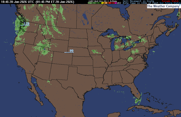
NWS WATCH / WARNING DISPLAY (LINKED…CLICK MAP, THEN YOUR AREA)

NWS DOPPLER RADAR LOOP (LINKED, CLICK RADAR MAP)

RAP RADAR (CLICK IMAGE THEN GO TO LOOP DURATION AND PICK LENGTH OF LOOP, THEN CLICK RADAR SITE)
WUNDERGROUND RADAR SUMMARY MAP (CLICK FOR UPDATES)
PRECIPITATION TYPE (CLICK TO ACCESS ANIMATION FEATURE)

CARIBBEAN RADAR (CLICK IMAGE)

You may direct any questions by contacting me personally, ANYTIME, at: [email protected]
Have a blessed day!
T. F. “STORM” WALSH III
GMCS, USCG (ret)
METEOROLOGIST / HURRICANE SPECIALIST /SEVERE WEATHER SPECIALIST


 English (US) ·
  French (CA) ·