

 4 hours ago
5
PROTECT YOUR DNA WITH QUANTUM TECHNOLOGY
Orgo-Life the new way to the future Advertising by AdpathwayBrazil's new deforestation figures and a tripling of fire counts show two different threats moving in opposite directions, and NASA researchers say standard satellite counts are missing many of the fires.
Brazil's government announced on Friday, Oct. 16, that Amazon deforestation from August 2025 through July 2026 fell to 3,335 square kilometers (1,300 square miles), the lowest since records began in 1988, the Associated Press reported. In the same report, AP noted that fire counts across the biome, near historic lows earlier this year, have tripled since Oct. 4.
That gap is the new story — deforestation statistics track forest that is cleared outright, while fire burns through standing forest and degrades it, often under a canopy that hides the flames from orbit. AP reported that degradation from fires, logging and drought now affects about 40 percent of the Amazon and has outpaced clear-cutting in recent years.
Developing Story Note: This report covers new developments involving Amazon fires, deforestation data and Brazil's fire investigations. Information may change as Brazil's government, NASA researchers and investigators release additional findings. Latest verified update: Brazil's deforestation announcement on Oct. 16, 2026, as reported by AP. Fire figures are preliminary and come from satellite data through mid-October 2026.
For readers outside Brazil, the stakes are global. The Amazon stores vast amounts of carbon and generates moisture that helps shape weather far beyond South America, so a forest that stays standing but burns repeatedly can still lose much of that value.
Record-Low Clearing, Rising Fire
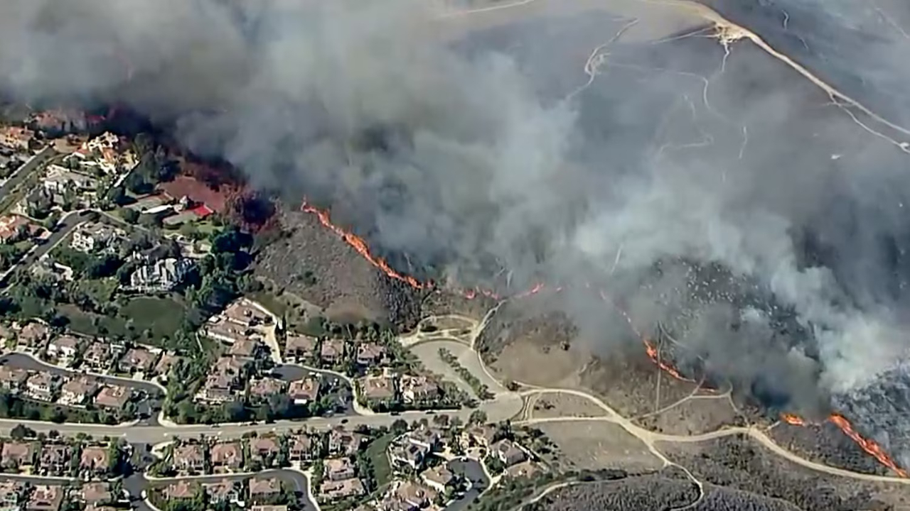
Brazil's new figures point to stronger enforcement against illegal clearing. The fire numbers point the other way. Brazil's Amazon surveillance system recorded 1,679 fires in Amazonas state in the first two weeks of October, a 253 percent jump over the same period last year, according to Reuters data cited by Gizmodo.
Brazilian authorities are also investigating whether some of the fires were set deliberately, including for political motives ahead of the Oct. 25 presidential runoff, AP reported. "The indications are that there has been a premeditated effort," Environment Minister João Paulo Capobianco told AP, as published by CBC News. No findings have been released, and it is not clear who set the fires or why.
Nature World News previously reported on smoke that choked Manaus as NASA described the Amazon as the second stage in an El Niño fire chain that began in Indonesia. Since that report, Brazil's deforestation data and the arson investigation have changed the central question from how bad the smoke is to what kind of damage the forest is actually taking.
Fires Hidden Under the Canopy
Satellites detect fires by their infrared heat, but thick smoke, clouds, and dense tree cover can block that signal. Low-intensity fires creeping through the understory are the hardest to see.
Shane Coffield, a University of Maryland assistant research scientist working at NASA Goddard, is mining data from the VIIRS satellite instrument to find fires that fall below the threshold for NASA's official FIRMS fire maps. Around Santarém, his team found about 40 percent more fires than standard active-fire counts show, and 50 to 70 uncontrolled fires in that region alone, according to NASA Earth Observatory. On the smokiest days, he said, satellites return very few detections, "and we know that isn't right."
The forests burning now are not fresh targets. NASA Goddard Earth system scientist Douglas Morton said many of the same forests burned during the El Niño events of 2015 and 2023. Earlier fires left partly charred trees that make the remaining forest more flammable, so some of this year's fires may burn hotter. Most rainforest species are not adapted to fire.
Nearly all of these fires are human-caused. Lightning ignites less than 1 percent of fires in the Brazilian Amazon, NASA said, and many large blazes started as pasture or field burns that escaped into a forest dried by drought. Manaus rainfall ran 95 percent below normal in August and 60 percent below normal in September, according to Brazil's national weather institute.
Separating Evidence From Allegation
The strength of each claim differs. The deforestation total is an official annual government figure. The hidden-fire estimate comes from an ongoing NASA Earth Action analysis, not a peer-reviewed study, and Coffield plans to share the candidate fire locations with MapBiomas, a Brazilian mapping network, for further checking. Monthly fire counts are preliminary satellite tallies.
The arson investigation is an allegation under review. Capobianco's statement reflects the government's early assessment, not a court finding. A field coordinator for Brazil's protected-areas agency told AP that fires start for many reasons, from escaped land-clearing burns to retaliation against enforcement.
What the evidence does support is a clear pattern — El Niño drought is turning ordinary burning into uncontrolled forest fire, and standard counts likely understate it.
Next Waves Expected North, Then South
Morton expects fires near Manaus and Santarém to keep burning until the rainy season arrives in December or January. The next wave is expected farther north in November and December, in the Brazilian states of Roraima, northern Pará and Amapá, plus parts of Venezuela, Guyana and Suriname. Drought and fire risk in the southern Amazon regions of Brazil and Paraguay are expected to peak around August and September 2027.
The people most affected are the more than 2 million residents of Manaus and smaller river towns facing heavy smoke, especially children, older adults, and people with heart or lung disease. Travelers headed to the region should check local air quality, carry N95 masks, and follow guidance from Brazilian health authorities. U.S. residents face no direct smoke risk, but the fires feed into the same global carbon and climate records that track this El Niño.
Amazon Fire Season Timeline
Oct. 16, 2026: Brazil reports record-low annual deforestation as fire counts remain elevated.
Oct. 15, 2026: AP reports Brazil is investigating whether fires were set deliberately.
Oct. 12, 2026: NASA's Aqua satellite images heavy smoke over Manaus.
Oct. 4, 2026: First round of Brazil's national election; fire counts later triple from this date.
September 2026: Satellites detect sharp increases in fire activity in the central and eastern Amazon.
Nature World News will track Brazil's investigation, new satellite fire tallies and the northward shift of the fire season. The bottom line: Brazil is cutting less forest than at any point on record, but fire is now doing damage that deforestation numbers do not capture.
What Readers Want to Know
Is Amazon deforestation going down?
Yes. Brazil reported 3,335 square kilometers cleared from August 2025 to July 2026, the lowest since records began in 1988.
Then why are the fires getting worse?
El Niño drought has dried the forest, and fires set on pastures and fields are escaping into it. Fire counts have tripled since Oct. 4.
What are the hidden fires?
They are lower-intensity fires burning under the canopy or beneath smoke that standard satellite products miss. NASA researchers found about 40 percent more fires near Santarém than official counts show.
Were the fires set on purpose?
Brazilian authorities are investigating. The environment minister said early indications point to a premeditated effort, but no findings have been released.
When will the fires end?
NASA expects relief near Manaus and Santarém once rains arrive in December or January, with fire risk shifting north and later south into 2027.
Does this affect the United States?
Not through smoke, but the fires release stored carbon and are tracked in global climate data tied to the same El Niño.
© 2026 NatureWorldNews.com All rights reserved. Do not reproduce without permission.











 English (US) ·
 French (CA) ·