

 9 hours ago
6
9 hours ago
6
PROTECT YOUR DNA WITH QUANTUM TECHNOLOGY
Orgo-Life the new way to the future Advertising by AdpathwayThe Weather Prediction Center (WPC) has placed a large part of the Desert Southwest under a Moderate Risk of excessive rainfall, level 3 of 4, for Monday, as moisture tied to Hurricanes Polo and Odalys streams north into Arizona, New Mexico, southern Utah and southwestern Colorado. In its Sunday morning excessive rainfall discussion, issued at 4:32 a.m. EDT, the center kept a broad Moderate Risk over the region's complex terrain and burn scars and extended it into southeastern New Mexico, where soils remain nearly saturated from recent heavy rain. A second Moderate Risk stretches from southeastern Arizona to the Texas Panhandle on Tuesday.
The Monday threat has grown in recent days. As recently as Saturday afternoon, the National Weather Service office in Phoenix described WPC's Monday outlook for most of Arizona as a Slight Risk, level 2 of 4. WPC uses the Moderate category when it expects at least a 40 percent chance that rainfall will exceed local flash flood guidance within 25 miles of a given point.
The biggest concern is not a single cloudburst but repeated rounds of heavy rain falling on ground that is already soaked. Residents near burn scars, arroyos and low-water crossings face the most immediate danger, along with hikers heading into slot canyons.
Moderate Risk Spans Four States Into Midweek
WPC expects rain to break out across much of the region by midday Monday as deep moisture is drawn northeast ahead of an upper-level low dropping south across California. Atmospheric moisture is forecast to run 2 to 3.5 standard deviations above normal. The Monday outlook is valid from 8 a.m. EDT Monday to 8 a.m. EDT Tuesday. WPC said thick clouds may limit instability, but strong lift and unusually moist air could still produce very efficient rainfall.
In Arizona, the National Weather Service in Phoenix said Saturday that model guidance still pointed toward a "significant weather event" early in the week, with the heaviest rain now most likely late Monday night and Tuesday. Its forecast called for about 1 inch of rain in the Phoenix area and 1 to 2 inches over the high terrain north and east of the city, with some spots reaching 3 inches over two days. The office also said a few severe thunderstorms with damaging winds and large hail are possible Tuesday.
Flood Watches now cover much of central, northern and southeastern Arizona. In southeast Arizona, including Tucson, a watch runs from 11 a.m. Monday through 11 p.m. Tuesday, KOLD News 13 reported.
In New Mexico, the National Weather Service in Albuquerque issued a Flood Watch early Sunday for areas along and west of the central mountain chain, in effect from Monday morning through late Tuesday night. The watch names Albuquerque, Santa Fe, Española, Taos, Socorro, Ruidoso, Los Alamos, Grants, Gallup and Farmington, and it flags recent burn scars, including those around Ruidoso and the Frijoles, Sacaton, Hummingbird and Whiskey burn scars.
Burn Scars, Slot Canyons and Soaked Ground in Southeastern New Mexico
Southeastern New Mexico enters this round already waterlogged. NWS Albuquerque said preliminary rainfall totals over the past two weeks have been extraordinary, with some rivaling entire summer monsoon averages and several stations on track to set all-time September records. As of Saturday, the Pecos River near Lake Arthur, south of Roswell, was forecast to reach minor flood stage.
The Ruidoso area remains a top concern. Last Wednesday, the NWS issued a flash flood warning for the South Fork burn scar in Lincoln County, with heavy flow and debris expected along Cedar Creek, Eagle Creek and the Rio Ruidoso, the Albuquerque Journal reported. Burned slopes shed water quickly and can send debris flows across roads with little notice.
Southern Utah and northern Arizona present a different danger. In its outlook for Wednesday and Thursday, WPC named dry washes, burn scars, slot canyons and higher terrain as the most sensitive areas, especially where rain falls on top of earlier downpours. A storm miles upstream can send a flash flood through a narrow canyon under clear skies.
Households with the least margin for error include people in mobile homes and low-lying older houses, drivers who rely on low-water crossings, rural residents on unpaved roads, and families still cleaning up from earlier floods.
Two Pacific Hurricanes, One Desert Flood Setup
Neither hurricane is expected to reach the United States. As of 2 a.m. MST Sunday, Polo was a Category 3 hurricane with maximum sustained winds near 120 mph, centered about 300 miles southwest of Cabo San Lucas. Hurricane Warnings cover parts of both coasts of Baja California Sur, and the National Hurricane Center (NHC) expects Polo to approach the peninsula's west coast Monday, cross it Monday night and approach northwestern mainland Mexico by early Tuesday.
In NHC Discussion 27, forecaster Hagen wrote that Polo should become a remnant low and dissipate before reaching the southern U.S., but that distant moisture from Polo and Odalys "may indirectly contribute to a heavy rainfall and flash flood threat" in the Southwest. The center also noted higher-than-usual model spread in how fast Polo will move after landfall.
WPC described the setup as a predecessor rainfall event, in which heavy rain develops ahead of the main plume of tropical moisture. The upper-level low pulls that moisture north, and strong southwesterly winds push it up against high terrain in Arizona, New Mexico, Utah and Colorado, squeezing out rain.
Nature World News reported last week on Polo's rapid intensification off Mexico and a separate New Mexico flood threat. What is new now is a Moderate Risk covering four states on consecutive days, with a second surge landing on ground that has not dried out.
The Moderate Risk is a probabilistic outlook, not a warning. It does not mean every community will flood, and it does not predict exact rainfall for any town. WPC said guidance is slowly converging but still differs on where and when the heaviest rain will fall later in the week.
Warning Signs, Road Safety and Flood Insurance Gaps
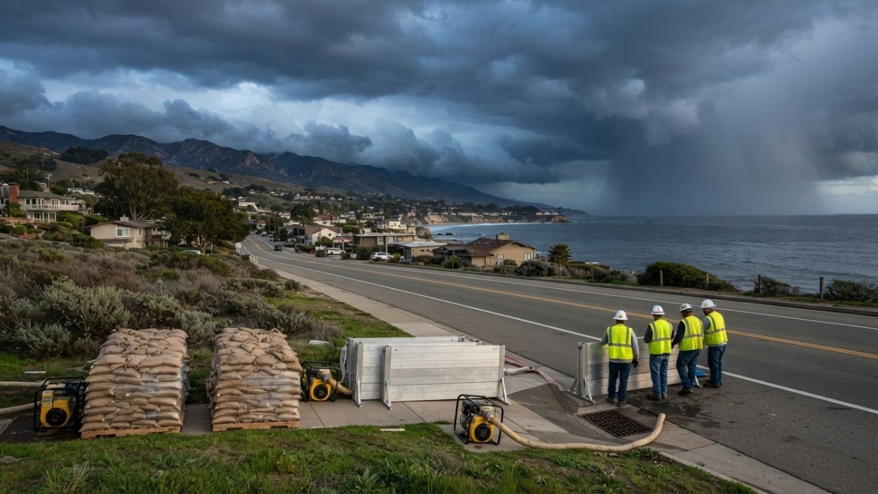
A Flood Watch means conditions favor flooding, while a Flash Flood Warning means flooding is happening or imminent. If a warning is issued, move to higher ground and follow local emergency officials. Never drive into water covering a road.
Watch for fast-rising water in arroyos, a roar from upstream, debris-laden runoff and rocks on mountain roads. Near burn scars, know two ways out and keep emergency alerts turned on. Check county emergency management pages for sandbag locations.
Cost is another pressure point. Standard homeowners and renters policies generally do not cover flood damage, and new policies through the National Flood Insurance Program typically carry a 30-day waiting period, too late for this week's storms. Photographing belongings now can help with later claims.
Forecast Checkpoints Monday Through Thursday
The biggest unknowns are where the heaviest bands set up and how quickly the upper-level low moves east. Updated WPC outlooks, NHC advisories and new NWS watches will sharpen the picture. WPC already has a Slight Risk, level 2 of 4, from Arizona and Texas into Iowa and Illinois on Wednesday, and from Texas to the Arkansas and Missouri state line on Thursday, as the moisture spreads east. WPC also noted that a European model index of unusual weather continues to signal a potentially significant rainfall event Tuesday across eastern Arizona and west-central New Mexico.
The latest outlooks point to a widespread flash flood threat Monday and Tuesday, with southeastern New Mexico, burn scars and slot canyons most exposed. Monitor NWS alerts, stay off flooded roads and follow local officials.
What Readers Want to Know
What does a Moderate Risk of excessive rainfall mean?
It is level 3 of 4 on the Weather Prediction Center's scale and signals at least a 40 percent chance that rainfall will exceed flash flood guidance within 25 miles of a point. It is an outlook, not a warning, so residents should still watch for NWS Flood Watches and Flash Flood Warnings.
Which areas face the highest flash flood risk this week?
WPC's Monday Moderate Risk covers the complex terrain and burn scars of southern Utah and southwestern Colorado, plus much of northern and central Arizona and New Mexico, extending into southeastern New Mexico. On Tuesday, the Moderate Risk shifts toward southeastern Arizona and New Mexico, including southeastern New Mexico, and into the Texas Panhandle.
Will Hurricane Polo hit Arizona or New Mexico?
No. The National Hurricane Center expects Polo to cross Baja California Sur, approach northwestern mainland Mexico and dissipate over northern Mexico before reaching the United States. Moisture from Polo and Odalys is what feeds the U.S. flood threat.
How much rain could fall around Phoenix?
NWS Phoenix's Saturday forecast called for about 1 inch in the Phoenix area and 1 to 2 inches over higher terrain north and east of the city, with some spots near 3 inches over two days. Totals could shift as the forecast is updated.
What should I do if a Flash Flood Warning is issued?
Move to higher ground immediately, avoid arroyos and low-water crossings, and never drive into floodwater. Follow evacuation or shelter instructions from local emergency officials.
When will the flood threat ease?
The heaviest Southwest rain is expected Monday into Tuesday. WPC still shows a Slight Risk from Arizona and Texas into the Midwest on Wednesday and from Texas toward the Arkansas and Missouri line on Thursday, while NWS Phoenix expects drier air to reach western Arizona on Wednesday. Check the latest NWS forecasts each day, because timing could shift.
© 2026 NatureWorldNews.com All rights reserved. Do not reproduce without permission.

















 English (US) ·
  French (CA) ·