
PROTECT YOUR DNA WITH QUANTUM TECHNOLOGY
Orgo-Life the new way to the future Advertising by Adpathway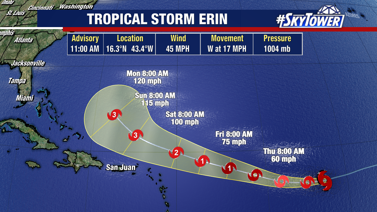
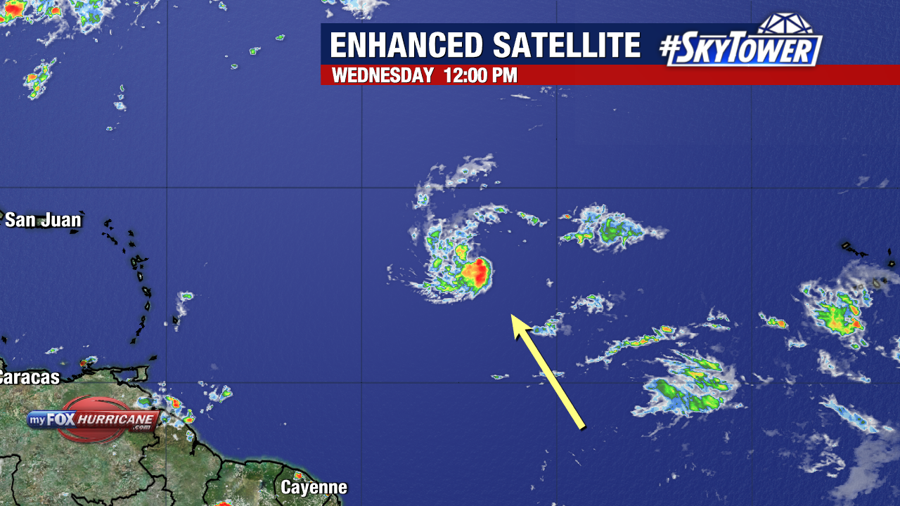
All eyes remain on Tropical Storm Erin as it continues to push across the central Atlantic.
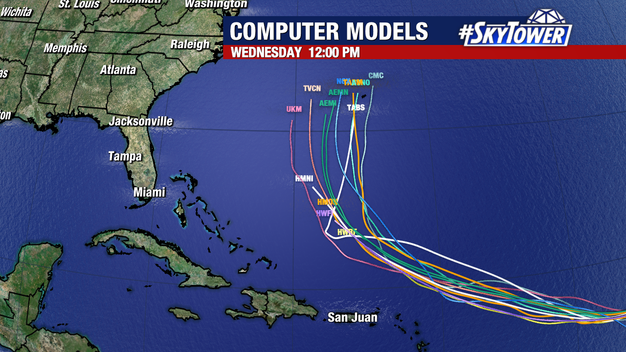
Erin should become the first hurricane of the season before the week ends, and weather models are now leaning toward it steering well east off the east coast of Florida next week.
Residents in the northern Leeward Islands, Virgin Islands, and Puerto Rico should monitor the immediate progress of this system closely. While confidence in the forecast track is increasing, it’s still too early to determine potential impacts for the Greater Antilles, Bahamas, Bermuda, or other parts of the eastern U.S. coastline.
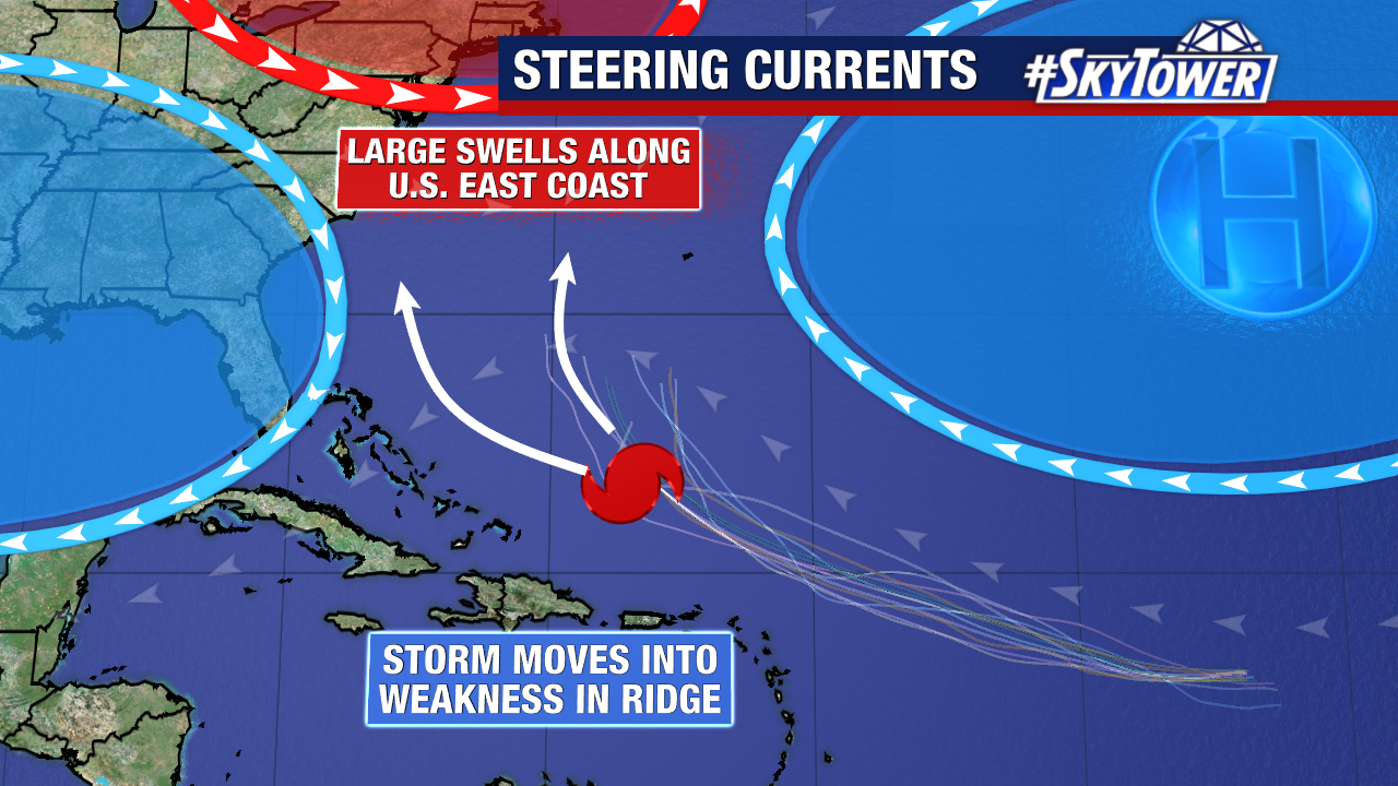
The forecast is becoming clearer with each update, and the Hurricane Hunters are scheduled to fly through Erin on Thursday to collect crucial data that will help fine-tune the track and intensity outlook. Warm ocean temperatures and low wind shear along Erin’s path are expected to support steady strengthening in the coming days. If the high-pressure ridge to the north weakens as expected, it would open a pathway for Erin to curve northward.
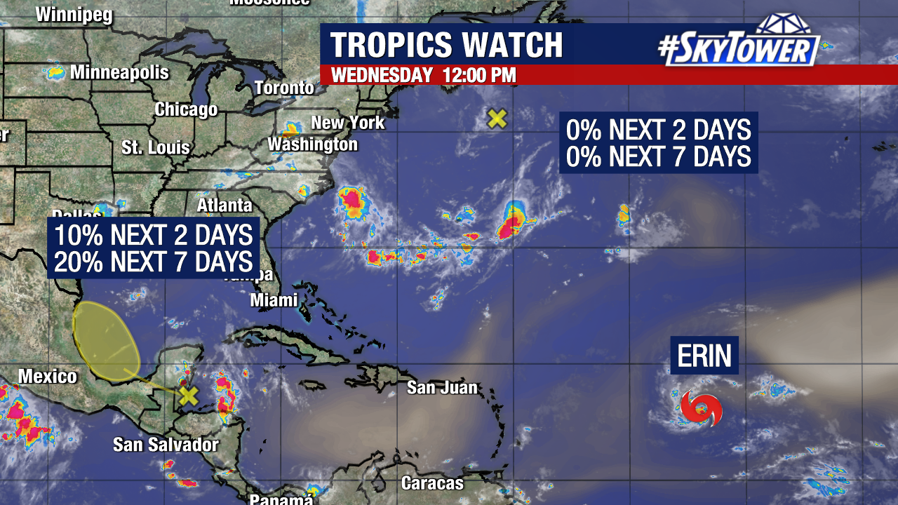
We are additionally watching the Bay of Campeche for a disturbance with a low (20%) chance of development. Early indications suggests a general a northwest movement for anything that forms there in the short term. Regardless, this wave is not expected to bring any impacts to Florida.
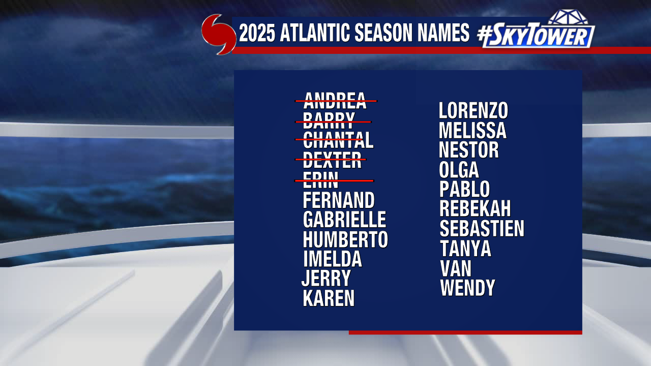
“Fernand” is the next name up on our 2025 storm naming list.


 English (US) ·
  French (CA) ·