
PROTECT YOUR DNA WITH QUANTUM TECHNOLOGY
Orgo-Life the new way to the future Advertising by AdpathwayLooks like a train of tropical waves in the Atlantic as two areas of interest spin behind Hurricane Erin’s path.
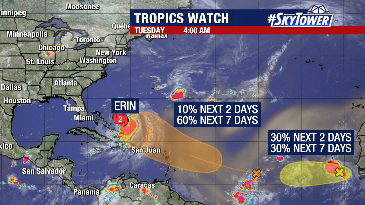
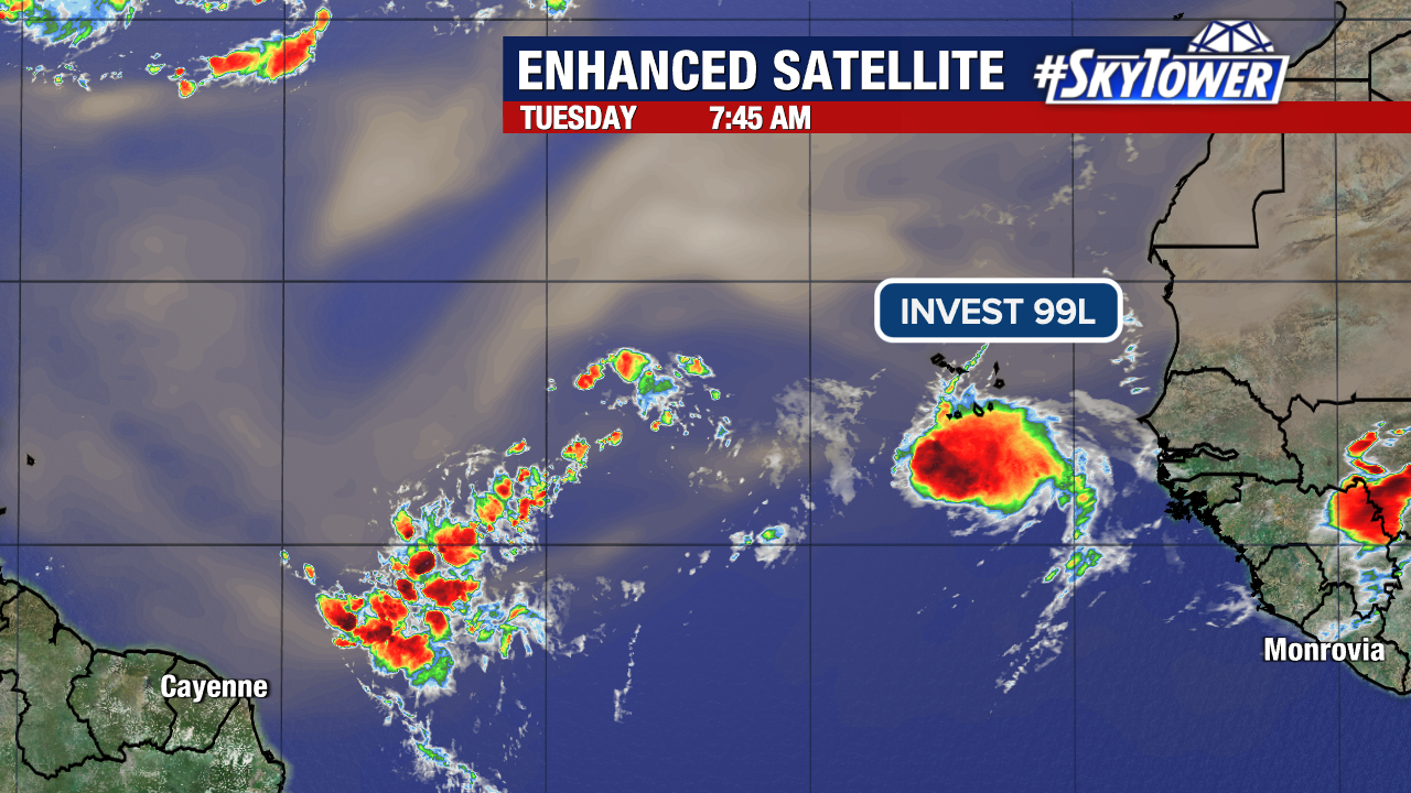
One wave just off the coast of Africa near the Cabo Verde Islands, Invest 99L, has a 30% chance to form in the next 7 days.
The disturbance is moving west around 15 mph but currently only has a low chance of development as it will run into less favorable conditions into this weekend.
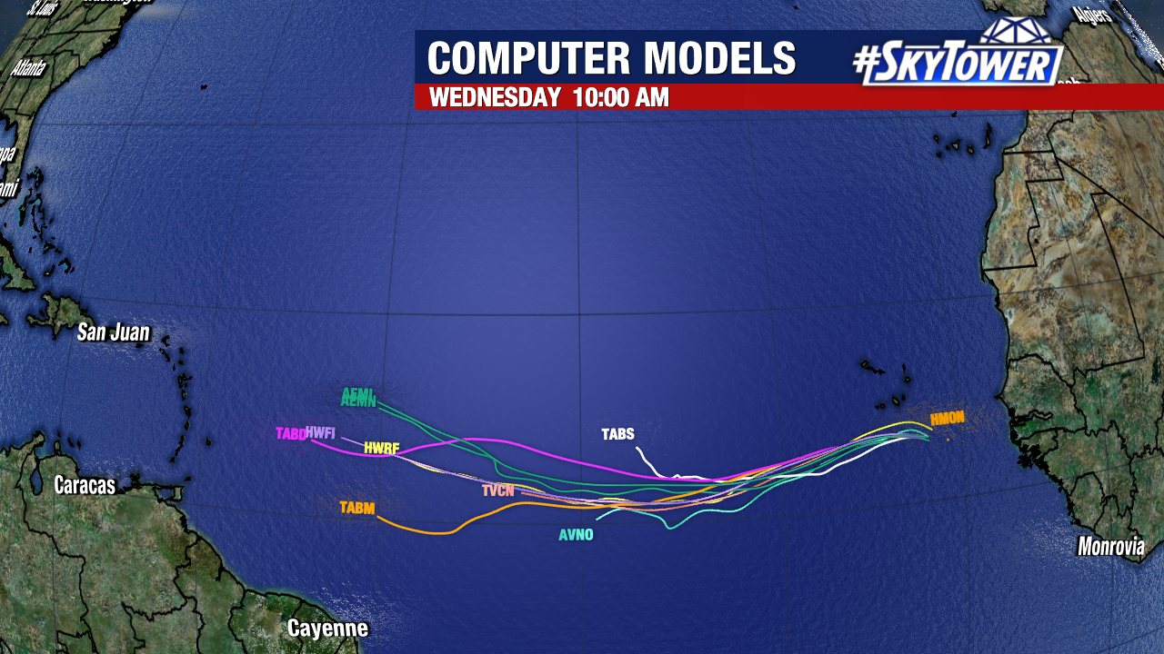
The other tropical wave just ahead of Invest 99L is producing a broad area of storms in the central Atlantic. This is moving at a quick 20 mph to the west-northwest and fighting off some dry air in the process.
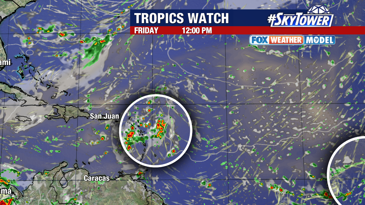
This disturbance will be near the Leeward Islands on Friday and could become a tropical depression later this week. Odds are 60% for something to form. Currently, the steering is in our favor for an east coast trough to help protect Florida and guide the storm east of us.
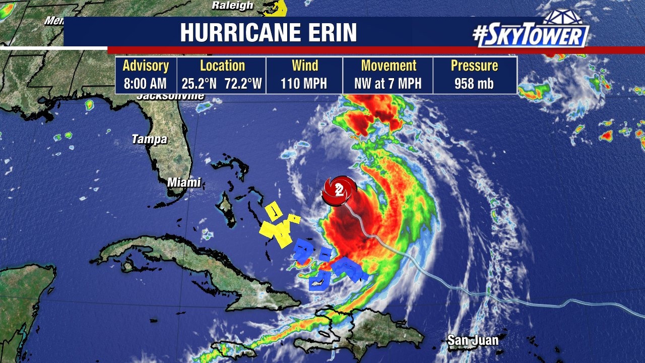
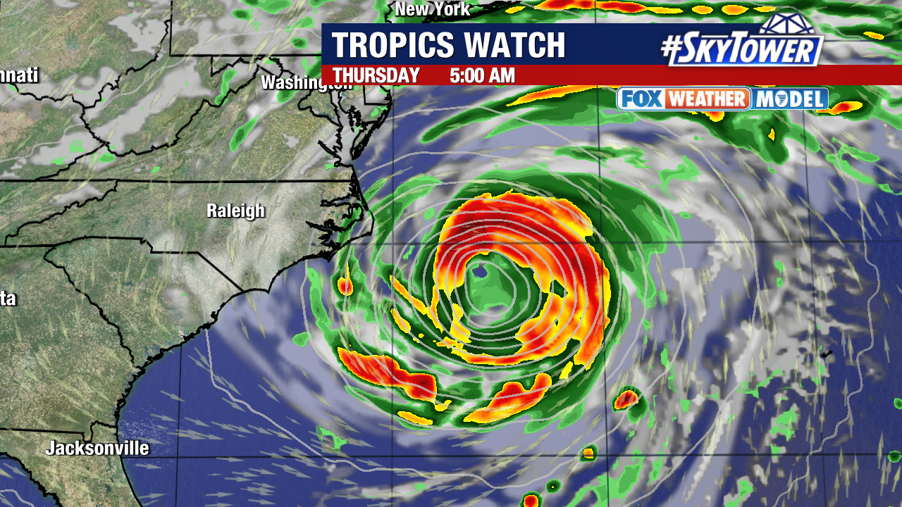
Hurricane Erin has started it’s turn to the northwest and slowed down to 7 mph during the process. It has weakened to a Category 2 storm with 110 mph sustained winds.
Things are on track for this to continue on a more northerly path before curving northeast out to sea.
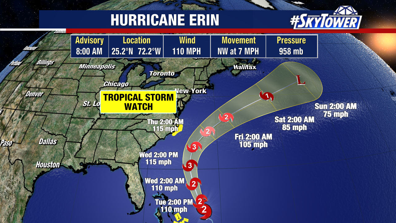
There are newly issued Tropical Storm Watches along the North Carolina Coast where Erin will make the closest pass to the U.S.
There’s also a Storm Surge Warning from Cape Lookout to Duck.
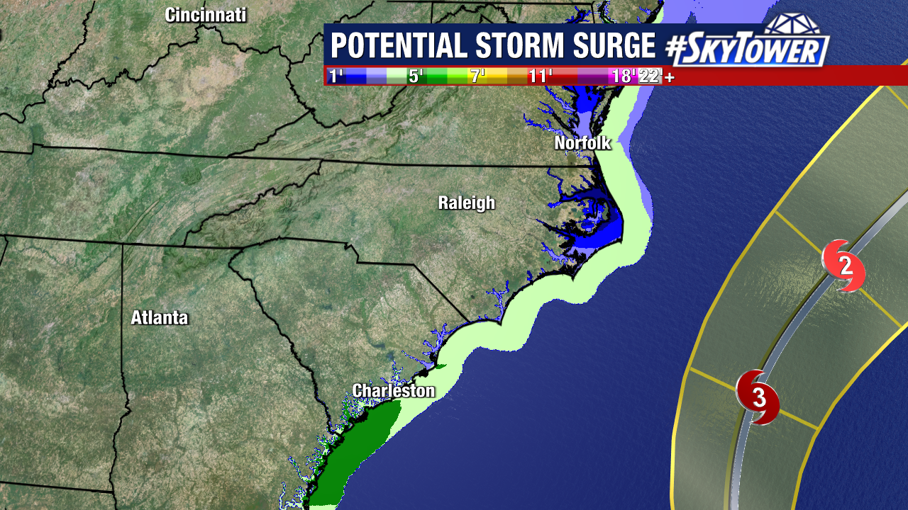
The outer rainbands from Hurricane Erin will bring tropical-storm force wind gusts and storm surge of 2-4′ above normal tide.


 English (US) ·
  French (CA) ·