
 6 months ago
103
6 months ago
103
PROTECT YOUR DNA WITH QUANTUM TECHNOLOGY
Orgo-Life the new way to the future Advertising by AdpathwayDisclaimer: This site is not affiliated with the National Hurricane Center, Hurricane Hunters, Storm Prediction Center, or National Weather Service. ALL forecasts herein are the result of my analysis, (to which you will see me at times, insert excerpts from various agencies due to the nature of the importance of the information) and I am solely responsible for the content. As ALWAYS, follow the National Hurricane Center, National Weather Service, and your local Emergency Management officials for emergency decisions. In addition, this is strictly a FORECAST OFFICE. I CANNOT make decisions regarding travel plans, etc. My purpose, is to provide you the information, based solely on information I analyze, and the accuracy of the information at hand of the time of analysis, so you may make informed decisions.
(T. F. “Storm” Walsh)
For those who have donated to my site, your help has been greatly appreciated. If you are not aware, donations to my site help pay for subscriptions to sites I use as well as software updates, which provide all the models and information used in my forecasts. To donate, please click the DONATE button to the right side of the page, or on the graphic of the dog. Any help you provide is immensely appreciated!
DONATIONS ACCEPTED AND APPRECIATED


I will reiterate, my forecasts are based on the available information at the time of analysis, and are only as accurate as the information analyzed and the solutions provided.
Good day everyone!
The Storm Prediction Center (SPC) has issued a MARGINAL risk for severe thunderstorms in the current DAY 1 Outlook: ACROSS PARTS OF THE OHIO VALLEY…
…SPC SUMMARY…
Showers and isolated thunderstorms may be accompanied by strong wind gusts across parts of the upper Ohio Valley late this afternoon and evening.
SPC DAY 1 SEVERE THUNDERSTORM OUTLOOK (LINKED FOR OUTLOOK TEXT)
TORNADO PROBABILITY
Probability of a tornado within 25 miles of a point.
HAIL PROBABILITY
Probability of one inch diameter hail or larger within 25 miles of a point.
DAMAGING THUNDERSTORM WIND PROBABILITY
Probability of damaging thunderstorm winds or wind gusts of 50 knots or higher within 25 miles of a point.
The following is the current CSU – MLP severe weather forecast map:
CSU – MLP DAY 1 FORECAST (CLICK FOR LARGER IMAGE)
NSSL ML SEVERE PROBABILITIES FORECAST NOV. 15

DAY 1 PROBABILITY CONVERSION TABLE
SPC DISCUSSION EXCERPT: Large-scale ascent will spread across the OH Valley today ahead of a mid-level shortwave trough that will dig across the Great Lakes by this evening. An associated surface low will develop eastward across southern Ontario, with a cold front extending southward across the OH Valley/Midwest. This front will serve as the primary focus for isolated thunderstorms this afternoon and evening. Only modest daytime heating is forecast ahead of the front, which combined with limited low-level moisture should temper the amount of surface-based instability that can develop. Even so, a strongly sheared environment is expected given the strength of the low/mid-level flow forecast. Recent high-resolution guidance suggests weak frontal convection should develop by late afternoon/early evening across eastern OH/western PA and vicinity. Strong to locally damaging wind gusts are the primary concern, with convection expected to weaken with eastward extent into central PA this evening due to meager instability with the loss of daytime heating.
The following maps are tornado and significant tornado probabilities from NADOCAST:
12Z NADOCAST TORNADO PROBABILITY (CLICK FOR LARGER IMAGE)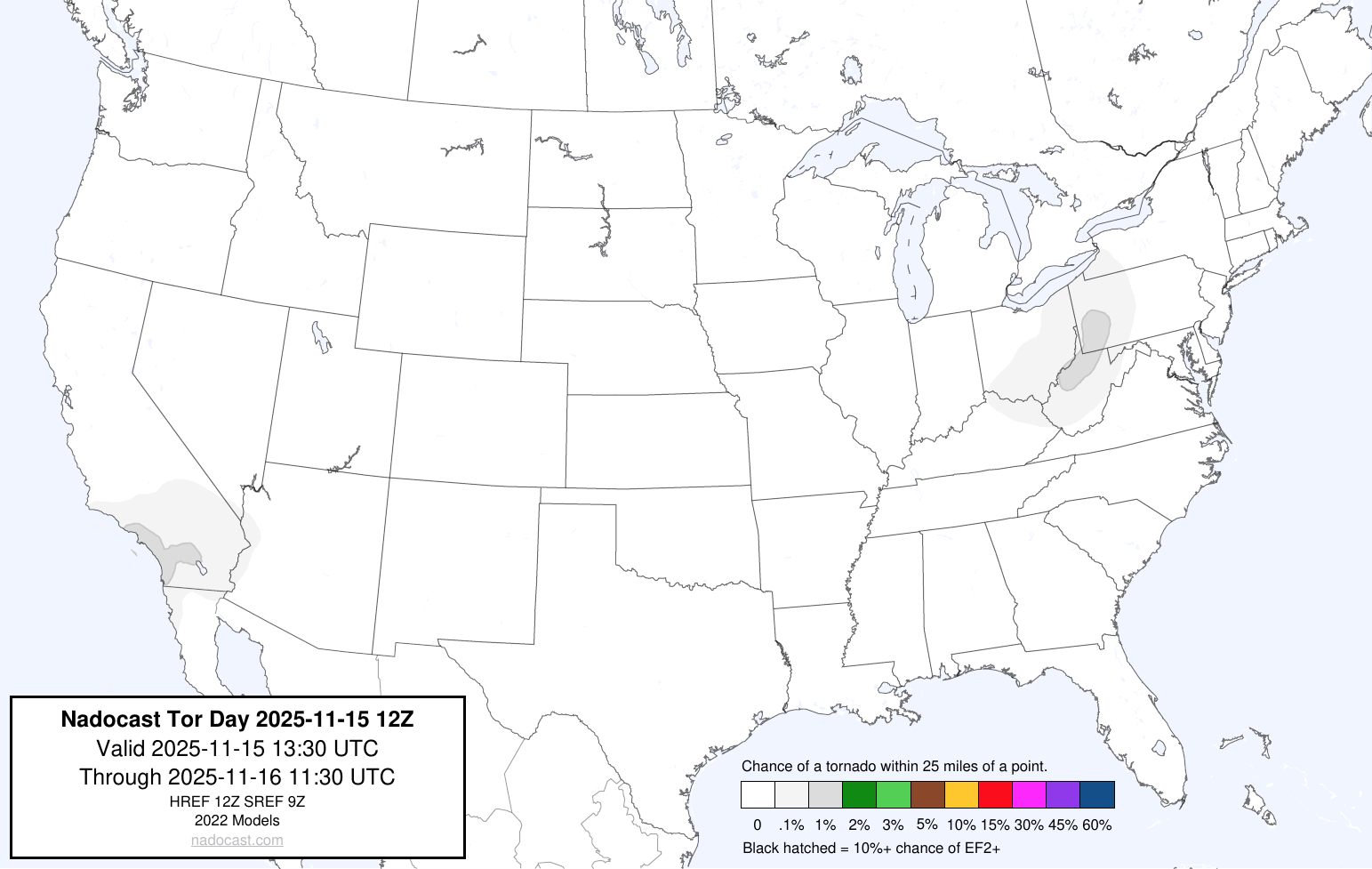
12Z NADOCAST SIGTOR PROBABILITY (CLICK FOR LARGER IMAGE)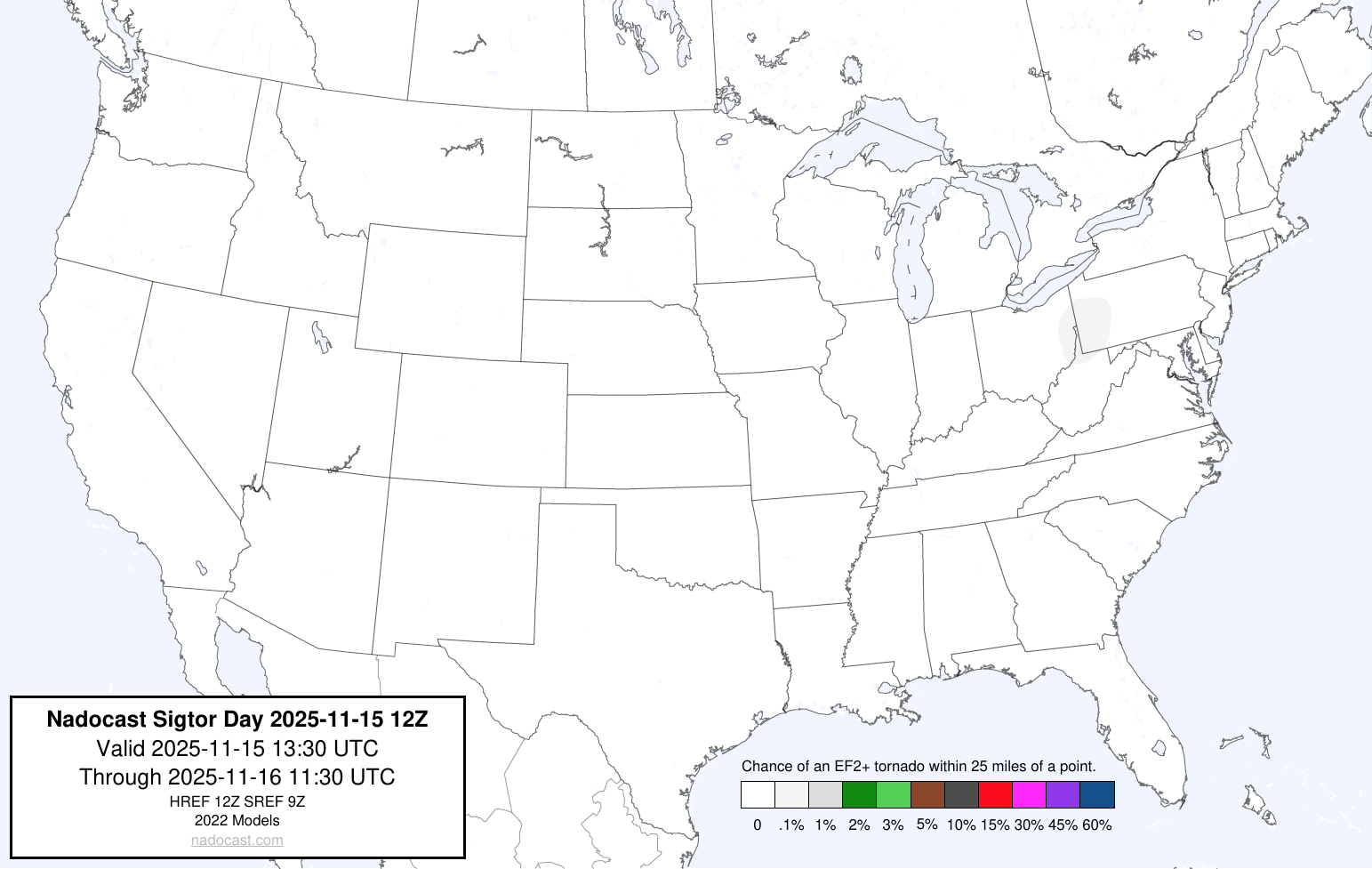
Based on my analysis of the severe weather indices, the forecast indicates CAPE values of only 250 j/kg-1. Though SRH (Storm Relative Helicity) values are forecast to run around 300 – 500 (m2 s-2), these alone will not produce tornadic activity. Instability will be meager to negligible at best. Given the deep layer helicity and bulk shear of 50 – 60 kts, strong, locally damaging wind gusts should be the primary factor. Given that instability will be next to nothing, I am excluding the analyzed indices for this forecast. Based on analysis of model animations, the current outlook, and analysis of indices, the strongest of any associated weather should occur approximately between late afternoon into evening.
Elsewhere, though the SPC has not designated any other areas, the CSU – MLP (Colorado State University – Machine Learning Probabilities) and NSSL ML (National Severe Storms Laboratory – Machine Learning) severe weather probability forecast models are indicating there could be the possibility of severe weather during next week. Given the analyzed values, most of the probabilities forecast indicates the possibility of MARGINAL severe weather. The CSU – MLP probability for NOV. 17 however, continues to lean toward a SLIGHT severe weather risk. Given these are machine learning forecasts, we are going to have to see how ACTUAL forecast conditions play out, as to whether or not the SPC issues any severe outlooks for next week. From the SPC:
Confidence in coverage of severe storms Day 5-6/Wed-Thu is uncertain. Large spread (and poor run-to-run consistency) exists among forecast guidance. The GFS and ECMWF-AIFS are more similar compared to the dynamical ECMWF, indicating a slower ejecting trough and only modest surface cyclogenesis until late Thursday when the low ejects northeast toward the Mid-MS Valley/Great Lakes. Furthermore, while strong southwesterly flow will overspread northward returning Gulf moisture across the Plains and south-central states, forcing for ascent will be somewhat limited on Wednesday as the trough ejects more slowly. As the trough ejects on Thursday and a cold front becomes a focus for storm development, boundary-parallel deep-layer flow and a northeastward ejecting cyclone may favor a more anafrontal, training convection/heavy rainfall scenario. While severe potential certainly is in play for Days 5-6/Wed-Thu, these uncertainties preclude 15 percent probabilities at this time.
Beyond Day 6/Thu, model disparity increases substantially and predictability is low.
The following are the CSU – MLP and NSSL probabilities forecasts
CSU – MLP SEVERE PROBABILITIES FORECASTS
NSSL ML SEVERE PROBABILITIES FORECASTS NOV. 17 – NOV. 20


Please use the following maps, which should update automatically, for Mesoscale Discussions and Convective Watches. You may have to refresh your browser, or click on the graphics. I have provided the SPC homepage link below, so you may get the updated information regarding any changes to the outlook:
https://www.spc.noaa.gov/classic.html
SPC MESOSCALE DISCUSSIONS (CLICK IMAGE FOR UPDATES)
SPC CONVECTIVE WATCHES (CLICK IMAGE FOR UPDATES)
The following sites will explain most of the severe weather and tornado values listed above, and will give you an idea of what to expect:
ENVIRONMENTAL INDICES AND PARAMETERS NWS
https://www.weather.gov/lmk/indices
THE WEATHER PREDICTION
http://www.theweatherprediction.com/severe/indices/
The following links will connect you to the Excessive Rainfall probabilities and River Flood Outlook:
EXCESSIVE RAINFALL
https://www.wpc.ncep.noaa.gov/qpf/excessive_rainfall_outlook_ero.php
SIGNIFICANT RIVER FLOOD OUTLOOK
https://www.wpc.ncep.noaa.gov/nationalfloodoutlook/index.html
The following NWS Watch / Warning map will provide local NWS information for your area. Click the image, then once it refreshes, click on your area of interest to view any special weather statements, hazards or advisories for your area.
NWS WATCH / WARNING DISPLAY (LINKED…CLICK MAP, THEN YOUR AREA)
NWS DOPPLER RADAR LOOP (LINKED, CLICK RADAR MAP)
RAP RADAR (CLICK IMAGE THEN GO TO LOOP DURATION AND PICK LENGTH OF LOOP, THEN CLICK RADAR SITE)
CARIBBEAN RADAR (CLICK IMAGE TO ACCESS ANIMATION)
You may direct any questions by contacting me personally, ANYTIME, at: [email protected]
Have a blessed day!
T. F. “STORM” WALSH III
GMCS, USCG (ret)
METEOROLOGIST / HURRICANE SPECIALIST /SEVERE WEATHER SPECIALIST


 English (US) ·
  French (CA) ·