
PROTECT YOUR DNA WITH QUANTUM TECHNOLOGY
Orgo-Life the new way to the future Advertising by Adpathway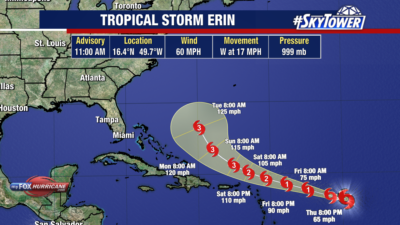
Erin is still on track to become the first and likely the first major hurricane of the season.
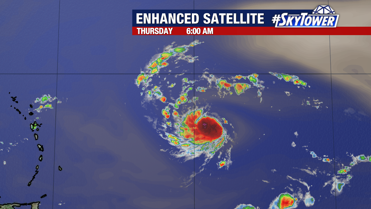
The tropical storm is slightly stronger and more organized today. Hurricane Hunters will be flying into the storm this evening to gather new data.
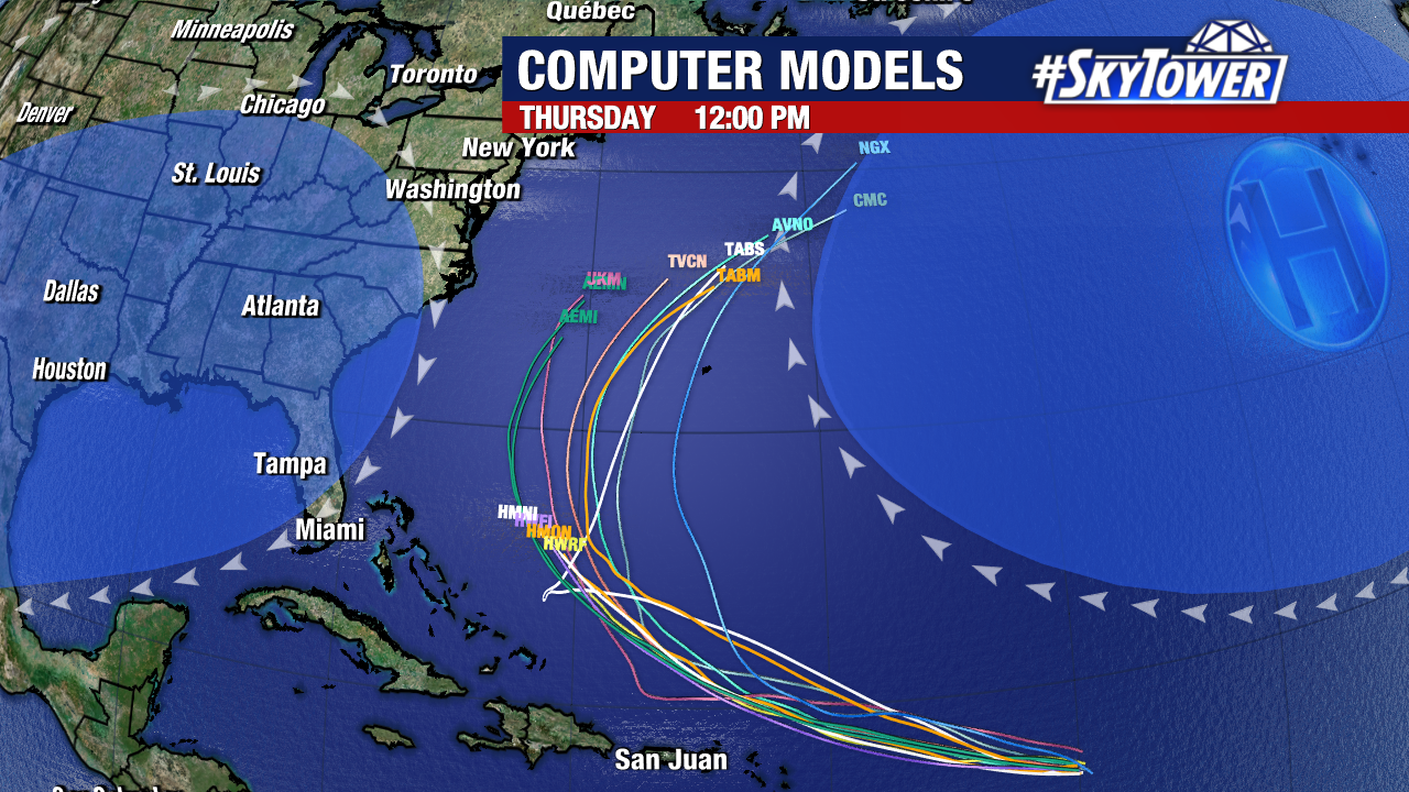
Forecast guidance remains steady, and a track well east of Florida still appears highly likely. Tropical-storm-force winds are possible in Puerto Rico, the Virgin Islands, and the northern Leeward Islands this weekend as Erin passes nearby.
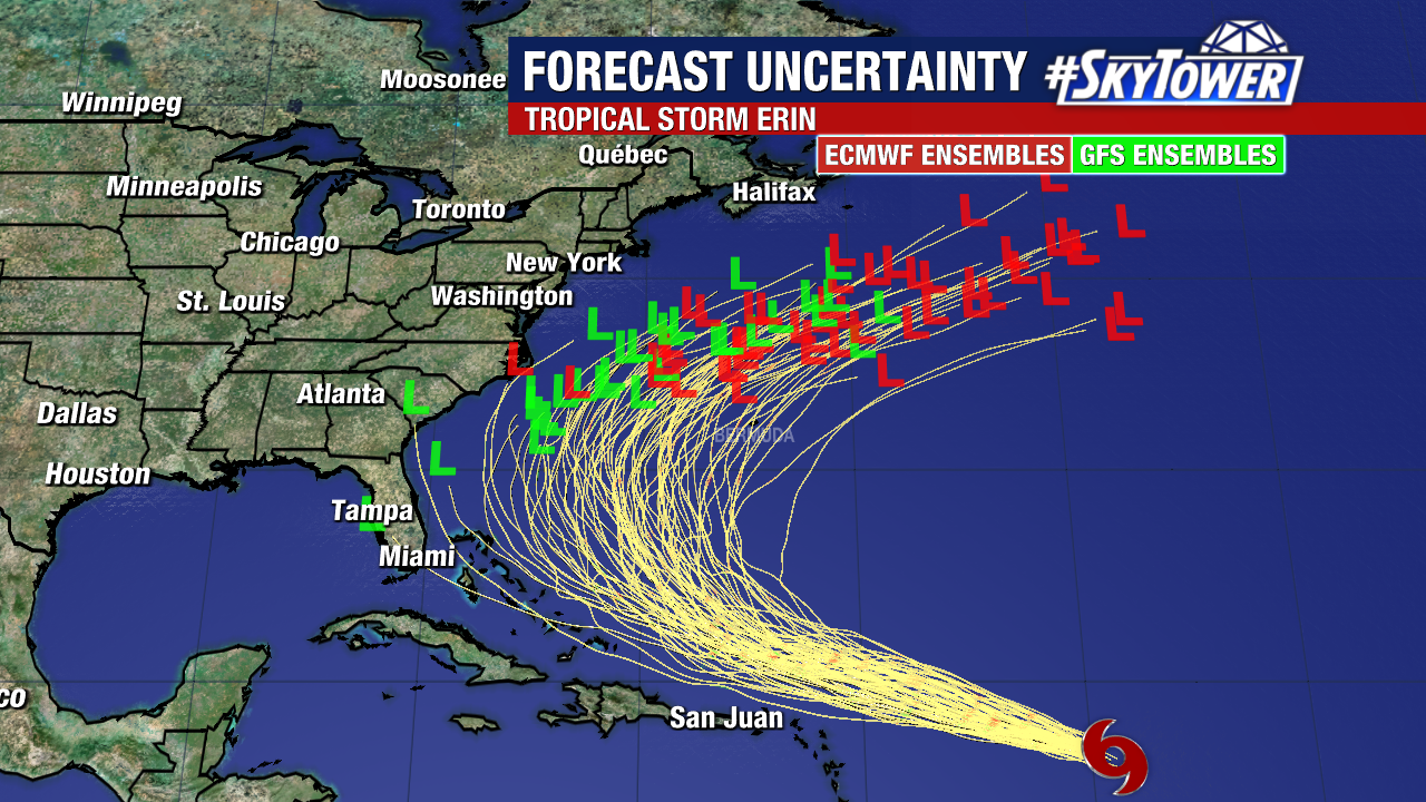
Beyond that point, there’s more variability in the forecast. Potential impacts along the U.S. East Coast and Bermuda next week will depend on Erin’s exact path. While a direct landfall appears unlikely at this time, a strong hurricane passing close enough could still bring coastal surge, dangerous surf, and rip currents. For now, the majority of weather models continue to keep Erin’s center east of the United States. Erin is still about 2,000 miles from the mainland U.S. (giving us several days to monitor any changes) and has not yet begun its expected northward turn. We’ll have a clearer picture of its path in the days ahead.
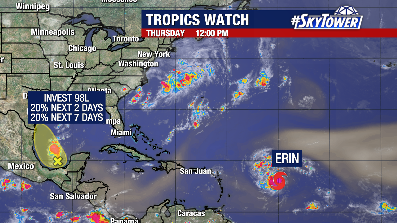
Meanwhile, Invest 98L still has a small chance of becoming a tropical depression or storm before moving ashore along the coastline of Mexico or Texas.
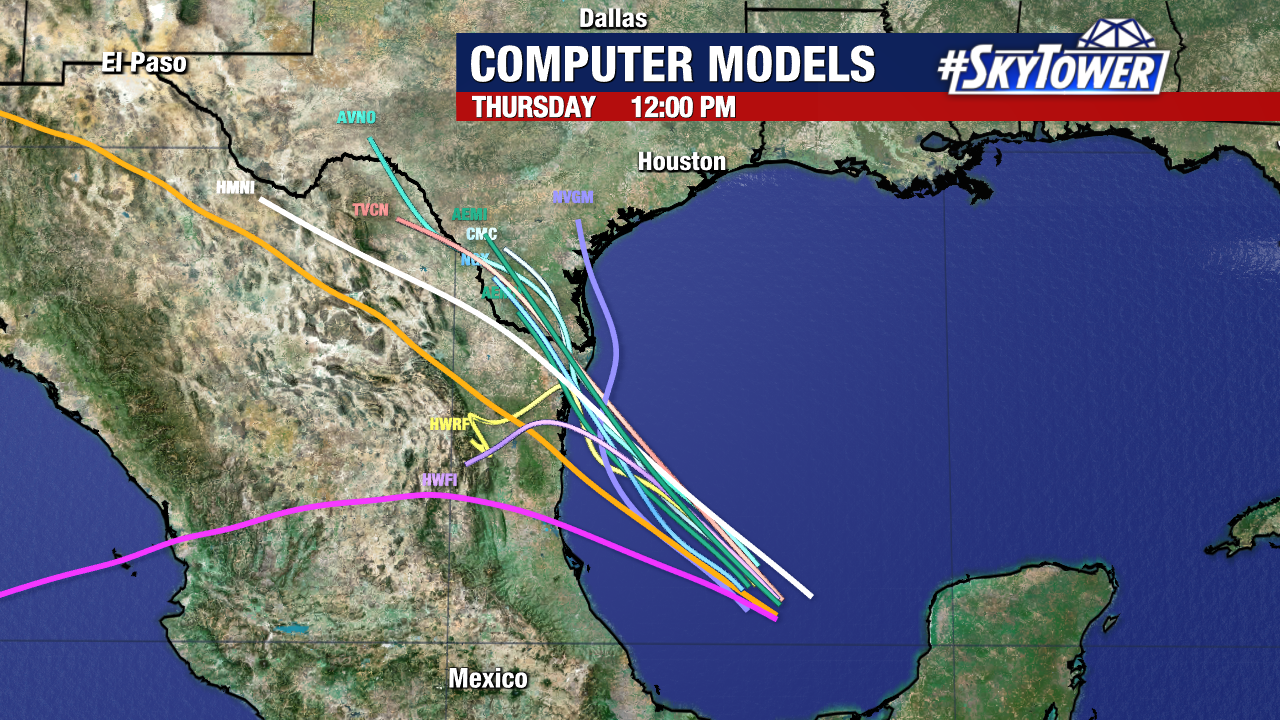
Regardless of development, it is not expected to become a strong system and will bring no impacts to Florida.
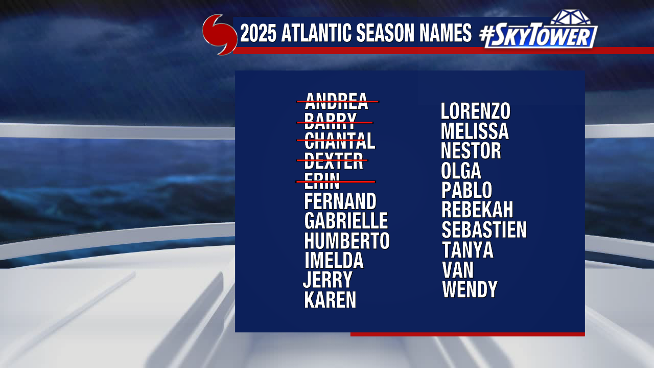
The next name on the 2025 storm naming list is “Fernand.”


 English (US) ·
  French (CA) ·